1
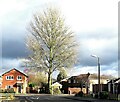
Lakenheath Drive, Sharples
Image: © philandju
Taken: 9 Dec 2021
0.07 miles
2
At the junction of Lakenheath Drive and Thornham Drive
A residential development in Sharples.
Image: © philandju
Taken: 9 Dec 2021
0.15 miles
3
Houses on Andrew Lane
In Sharples, Bolton.
Image: © philandju
Taken: 9 Dec 2021
0.17 miles
4
Open space by Northland Road
Northland Road at the far side appears to have been blocked off but remains as a private access road.
Image: © Bill Boaden
Taken: 28 Dec 2011
0.18 miles
5
Andrew Lane park, Sharples
Though small, this green area is a pleasant haven from the A666 to the right of the scene. The low beech hedge on the right, at least 50 years old, is a fine sight in late autumn when the leaves turn brown.
Image: © philandju
Taken: 19 Oct 2011
0.19 miles
6
Stone Cottages at Eagley Bank
In North Bolton. One side of the street (Park Row) is stone cottages, the other, a brick terrace built at a later date.
Image: © philandju
Taken: 19 Oct 2011
0.19 miles
7
Westcliffe Road, Sharples
Built pre - war, the short residential road connects Andrew Lane to Blackburn Road.
Image: © philandju
Taken: 19 Oct 2011
0.19 miles
8
Playfair Street, Eagley Bank
Probably, these houses would have been built to house workers at the nearby Eagley Mills where cotton was spun. The stone houses in Eagley Bank are a mix of small cottages, larger houses and a few more substantial dwellings, so that all grades of workers were suitably accommodated.
Image: © philandju
Taken: 19 Oct 2011
0.21 miles
9
Park View, Eagley Bank
Looking to the east, depicting the northernmost buildings of Park View.
Image: © Earnest Lad
Taken: 19 Jan 2004
0.23 miles
10
Vew of ancient path from Eagley Bank to Blackburn Road
View westwards of footpath that runs from Playfair Street/The Gardens towards Makants Farm and Blackburn Road (A666).
Image: © Earnest Lad
Taken: 30 Sep 2006
0.23 miles


