IMAGES TAKEN NEAR TO
Douglas Street, BOLTON, BL1 7AS
Introduction
This page details the photographs taken nearby to Douglas Street, BL1 7AS by members of the Geograph project.
The Geograph project started in 2005 with the aim of publishing, organising and preserving representative images for every square kilometre of Great Britain, Ireland and the Isle of Man.

There are currently over 7.5m images from over14,400 individuals and you can help contribute to the project by visiting https://www.geograph.org.uk
Image Map (Loading...)


Getting Data...Please wait
Leaflet Map data © OpenStreetMap
Images are licensed for reuse under creativecommons.org/licenses/by-sa/2.0
Notes
- Clicking on the map will re-center to the selected point.
- The higher the marker number, the further away the image location is from the centre of the postcode.
Image Listing (49 Images Found)
Images are licensed for reuse under creativecommons.org/licenses/by-sa/2.0
Image
Details
Distance
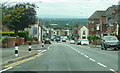
3
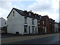
Bar Lane, Sharples
Bar Lane runs between Blackburn Road (A666) and Belmont Road (A675). The A666 was a turnpike road connecting Bolton with Blackburn and it is thought that there was a toll bar at the junction of the A666 and Bar Lane - hence the name.
Image: © philandju
Taken: 6 Jan 2023
0.03 miles
6
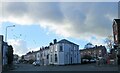
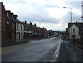
Road junction
Broad o' th' Lane and Wilton Road meet Belmont Road (A675) in Astley Bridge.
Image: © philandju
Taken: 3 Nov 2022
0.04 miles
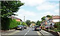
7
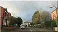
Belmont Road, Bolton
Climbing towards the moors.
Image: © Richard Webb
Taken: 22 Nov 2021
0.07 miles
8

Old Milestone by the A675, Belmont Road, Sharples, Bolton parish
Carved stone post by the A675, in parish of BOLTON (BOLTON District), Sharples, just North of Arundel Street, on pavement, on West side of road. Erected by the Sharples & Hoghton turnpike trust in the 19th century.
Inscription reads:-
ASTLEY BRIDGE
{---<.>---}
TO BOLTON
2 MILES.
TO PRESTON
17 MILES.
Milestone Society National ID: LA_PSBO17.
Image: © Phil Platt
Taken: 11 Nov 2011
0.08 miles
9
Wilmslow Avenue
Off Belmont Road in north Bolton.
Image: © philandju
Taken: 14 Sep 2022
0.08 miles
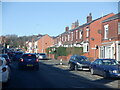
10
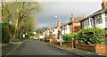
Ivy Bank Road, Sharples
A residential street in north Bolton.
Image: © philandju
Taken: 6 Jan 2023
0.10 miles