1
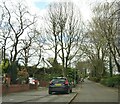
Flats on Moss Bank Way
At the junction of Broad o'th' Lane, Sharples Park and Moss Bank Way.
Image: © philandju
Taken: 19 Apr 2021
0.02 miles
2
Astley Bridge Cricket Club
Astley Bridge CC's Sharples Park ground.
Image: © BatAndBall
Taken: 20 Jun 2012
0.06 miles
3
Broad O' Th' Lane, Astley Bridge, Bolton
The lane originally connected Moss Bank Way (the ring road, A58) with Belmont Road (A675), but in the 1970s it became a rat run for vehicles avoiding the A58/A666 junction a few hundred yards away. The Council, much to the relief of residents, blocked the lane to through traffic just behind the photographer's position. This section of the lane is once more a quiet and pleasant backwater.
Image: © philandju
Taken: 11 Nov 2011
0.07 miles
4
Broad o' th' Lane
Originally the lane connected Moss Bank Way (A58) to Belmont Road (A675). It became a rat run for motorists avoiding the notoriously busy Astley Bridge junction of the A58, the A675 and the A666 a little further to the east. No doubt to the relief of residents, it has now been made into a cul de sac half way up its length, thus preventing through traffic.
Image: © philandju
Taken: 1 Apr 2022
0.07 miles
5
Sharples Park
On the right, but out of sight, is Thornleigh Salesian College, and behind the wall on the left, also out of sight, are the school playing fields.
Image: © philandju
Taken: 1 Apr 2022
0.09 miles
6
Astley Bridge Cricket Club - Pavilion
Astley Bridge CC's pavilion from the car park.
The club play their cricket in the Bolton Cricket League.
Image: © BatAndBall
Taken: 20 Jun 2012
0.13 miles
7
Bungalows on Broad o' th' Lane, Astley Bridge
Built in 1953.
Image: © philandju
Taken: 1 Apr 2022
0.14 miles
8
Bosco House
Originally named The Lees, the house was taken over by The Salesians of Don Bosco as accommodation for the priests who ran the adjacent Thornleigh College Grammar School and was renamed Bosco House. The building is now converted into apartments. The building is Grade 2 listed. The Salesian Order is named for St. Francis of Sales who was Don (St. John) Bosco's inspiration when he founded the order to educate children.
Image: © philandju
Taken: 24 Apr 2018
0.14 miles
9
School playing field and school buildings
The "first eleven" football pitch at Thornleigh College (or it was in my day). Sadly I never got to play on it. The building in the background was where some of the school teachers (RC priests) lived. The empty pop bottle in the foreground is de riguer these days.
Image: © Phil Platt
Taken: 12 Apr 2011
0.15 miles
10
R.C. parish church of The Holy Infant and St. Anthony
The present church was built in 1901/02 and opened in July 1902. A driving force behind the construction of the church was Fr. Vantomme, a Belgian who was parish priest 1893 - 1915. This photograph was taken from Vantomme Street, named after the priest.
Image: © philandju
Taken: 1 Apr 2022
0.16 miles


