IMAGES TAKEN NEAR TO
Dentdale Close, BOLTON, BL1 5XD
Introduction
This page details the photographs taken nearby to Dentdale Close, BL1 5XD by members of the Geograph project.
The Geograph project started in 2005 with the aim of publishing, organising and preserving representative images for every square kilometre of Great Britain, Ireland and the Isle of Man.

There are currently over 7.5m images from over14,400 individuals and you can help contribute to the project by visiting https://www.geograph.org.uk
Image Map
Images are licensed for reuse under creativecommons.org/licenses/by-sa/2.0
Notes
- Clicking on the map will re-center to the selected point.
- The higher the marker number, the further away the image location is from the centre of the postcode.
Image Listing (16 Images Found)
Images are licensed for reuse under creativecommons.org/licenses/by-sa/2.0
Image
Details
Distance
1
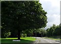
Glengarth Drive
A residential area in Lostock.
Image: © philandju
Taken: 21 Jul 2020
0.03 miles
2
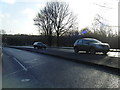
Beaumont Road approaching Glengarth Drive
Image: © Colin Pyle
Taken: 1 Feb 2011
0.08 miles
3
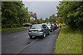
Mossdale Avenue
A popular place for parking?
Image: © Ian Greig
Taken: 8 Jun 2012
0.11 miles

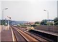
5
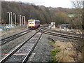
Lostock Junction
A Northern Rail train passes Lostock Junction; viewed from the platform at Lostock Station.
Image: © David Dixon
Taken: 8 Jan 2011
0.17 miles
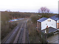
6
Lostock junction
Taken prior to resignalling of the Bolton area as part of the Manchester North scheme.
Image: © Peter Whatley
Taken: 24 Jul 1989
0.19 miles
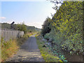
7
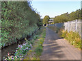
Middle Brook
The path along Middle Brook. Heaton Bridge can be seen ahead.
Image: © David Dixon
Taken: 1 Sep 2011
0.19 miles
8
Lostock Junction
Looking from the bridge at Rumworth Road, along the railway line from Wigan to the junction apprimately 150 yards to the east of Lostock Station. At this junction the Wigan line joins that from Preston, before continuing towards Bolton and Manchester.
Image: © David Dixon
Taken: 8 Jan 2011
0.21 miles
9
Confluence of Middle Brook and Bessie Brook
Image: © Alexander P Kapp
Taken: 25 Mar 2009
0.22 miles
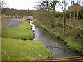
10
Middle Brook
The path alongside Middle Brook. The railway is behind the fence to the left; the top of the signal is visible above the line of the fence.
Image: © David Dixon
Taken: 1 Sep 2011
0.22 miles