
IMAGES TAKEN NEAR TO
Hayfield Close, BOLTON, BL1 2BP
Introduction
This page details the photographs taken nearby to Hayfield Close, BL1 2BP by members of the Geograph project.
The Geograph project started in 2005 with the aim of publishing, organising and preserving representative images for every square kilometre of Great Britain, Ireland and the Isle of Man.

There are currently over 7.5m images from over14,400 individuals and you can help contribute to the project by visiting https://www.geograph.org.uk
Image Map
Images are licensed for reuse under creativecommons.org/licenses/by-sa/2.0
Notes
- Clicking on the map will re-center to the selected point.
- The higher the marker number, the further away the image location is from the centre of the postcode.
Image Listing (6 Images Found)
Images are licensed for reuse under creativecommons.org/licenses/by-sa/2.0
Image
Details
Distance
1

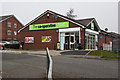
Grounds of Mere Hall
The lawns are turning brown after a rainless period.
Image: © philandju
Taken: 20 Jul 2018
0.07 miles
3
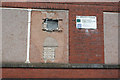
Mill Improvement Programme
The first flush of funding has clearly been exhausted. (Part of the Darley Street frontage of Brownlow Fold Mill No.2)
Image: © Alan Murray-Rust
Taken: 25 Jul 2012
0.20 miles
4
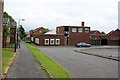
The Roundhouse Pub
Modern pub in a redeveloped area. The name seems incongruous given the rectangular shape, but the partly hidden conical roof gives the necessary clue.
Image: © Alan Murray-Rust
Taken: 25 Jul 2012
0.21 miles
5
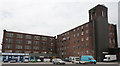
Brownlow Fold Mills - 3
No.2 Mill (left) and the remaining portion of No.1 Mill, which formerly occupied the foreground car park.
Image: © Alan Murray-Rust
Taken: 25 Jul 2012
0.24 miles
6
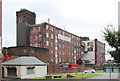
Brownlow Fold Mills - 1
The nearer building was an extension to No.1 Mill, the rest of which, nearer the camera, was demolished in 1961. The further building is No.2 Mill, dating from 1905. The mills now house smaller industrial units.
Image: © Alan Murray-Rust
Taken: 25 Jul 2012
0.25 miles