
IMAGES TAKEN NEAR TO
Charlton Close, BOURNEMOUTH, BH9 3PS
Introduction
This page details the photographs taken nearby to Charlton Close, BH9 3PS by members of the Geograph project.
The Geograph project started in 2005 with the aim of publishing, organising and preserving representative images for every square kilometre of Great Britain, Ireland and the Isle of Man.

There are currently over 7.5m images from over14,400 individuals and you can help contribute to the project by visiting https://www.geograph.org.uk
Image Map
Images are licensed for reuse under creativecommons.org/licenses/by-sa/2.0
Notes
- Clicking on the map will re-center to the selected point.
- The higher the marker number, the further away the image location is from the centre of the postcode.
Image Listing (33 Images Found)
Images are licensed for reuse under creativecommons.org/licenses/by-sa/2.0
Image
Details
Distance
1
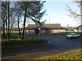
Muscliffe Community Centre
Operated by Bournemouth Council, used by groups as diverse as Coeliac UK, Ramblers & Age Concern, and no doubt many more. In the background, playing fields; to the right, youth centre. http://www.bournemouth.gov.uk/Residents/Community/Community_Development/centres.asp
Image: © Mike Faherty
Taken: 9 Dec 2008
0.09 miles
2
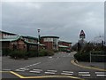
Throop: Muscliff Primary School
The school was opened in the mid-1990s to answer the needs of this rapidly growing housing estates and is now one of the most oversubscribed primary schools in Bournemouth.
Image: © Chris Downer
Taken: 3 Feb 2008
0.13 miles
3
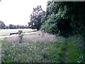
Muscliff: bridleway M18 reaches Muscliff Park playing fields
The bridleway briefly comes out into daylight from tree cover as it reaches the back of the playing fields. It continues into the trees ahead-right, while the parallel path abuts the fields directly.
See Image for the next picture along the bridleway ahead, and Image for the next view behind us.
Image: © Chris Downer
Taken: 7 Jul 2016
0.15 miles
4
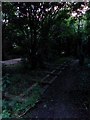
Muscliff: part of the fence is down alongside bridleway M18
It is 9:15 on a fairly bright summer's evening but here in the thick of the trees we have only the last vestiges of daylight as we look along this public bridleway. A modern footpath, broad and neatly gravelled, runs parallel to us and the fence along this stretch between the two has collapsed.
See Image for the next photo ahead, and Image for the next view along the path behind us, each giving further links to photos along the whole length of the bridleway.
Image: © Chris Downer
Taken: 7 Jul 2016
0.15 miles
5
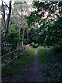
Muscliff: looking west along bridleway M18
This public bridleway runs between Broadway Lane and Muscliffe Lane, parallel with a modern path. See Image for the start on Muscliffe Lane (behind us) and Image for the next view ahead.
Image: © Chris Downer
Taken: 7 Jul 2016
0.17 miles
6
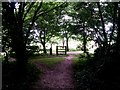
Muscliff: footpath M17 reaches bridleway M18
The opposite view to Image, showing the emergence of the public footpath onto the bridleway. Beyond, we see the modern gravelled path which runs parallel with the bridleway, and the playing fields of Muscliff Park.
See Image for a view of the bridleway past this point, and Image for the next view along the path behind us - these provide links to further photos along all the routes in all three directions.
Image: © Chris Downer
Taken: 7 Jul 2016
0.17 miles
7

Muscliff: bridleway M18 passes footpath M17
These two public rights of way meet here alongside the playing fields of Muscliff Park. We look along the bridleway, which runs parallel with a broad modern path (left), while the public footpath leads off to the right.
See:
Image for the next photo along the bridleway ahead;
Image for the next view behind us; and
Image for a view up the footpath to the right.
Each link contains further links to photos all along each route.
Image: © Chris Downer
Taken: 7 Jul 2016
0.17 miles
8
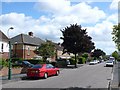
Larksfield Avenue, Bournemouth
View south east along this street in the heart of residential Bournemouth.
Image: © Nigel Mykura
Taken: 28 Aug 2009
0.18 miles
9
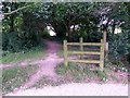
Muscliff: footpath M17 heads north
Looking along this rural path, which heads from the bridleway M18 which we see running left-to-right just behind the wooden fence.
We are standing on a modern gravel path which runs parallel with the bridleway.
See Image for the view towards us from along the path, and Image for along the bridleway just here - they provide links to further photos along the route in all three directions.
Image: © Chris Downer
Taken: 7 Jul 2016
0.18 miles
10
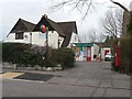
Throop: post office
Situated on Broadway Lane.
Image: © Chris Downer
Taken: 3 Feb 2008
0.18 miles