
IMAGES TAKEN NEAR TO
Strathmore Road, BOURNEMOUTH, BH9 3NT
Introduction
This page details the photographs taken nearby to Strathmore Road, BH9 3NT by members of the Geograph project.
The Geograph project started in 2005 with the aim of publishing, organising and preserving representative images for every square kilometre of Great Britain, Ireland and the Isle of Man.

There are currently over 7.5m images from over14,400 individuals and you can help contribute to the project by visiting https://www.geograph.org.uk
Image Map
Images are licensed for reuse under creativecommons.org/licenses/by-sa/2.0
Notes
- Clicking on the map will re-center to the selected point.
- The higher the marker number, the further away the image location is from the centre of the postcode.
Image Listing (97 Images Found)
Images are licensed for reuse under creativecommons.org/licenses/by-sa/2.0
Image
Details
Distance
1
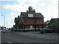
Red Hill, The Horse & Jockey
Edwardian-looking pub on Castle Lane. Internally, rectangular bar, with 2 rooms to left, front & right. Cask ales on offer at my visit: Courage Best & Director's, Gale's HSB, Sharp's Doom Bar. For some customer reviews, see http://www.beerintheevening.com/pubs/s/28/2836/Horse_and_Jockey/Bournemouth
Image: © Mike Faherty
Taken: 10 Feb 2009
0.03 miles
2
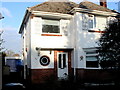
1159 Wimborne Rd Bournemouth
This is a typical 3 or 4 bedroom brick built 1930s detached house on one of the longest roads in Bournemouth. It is not easy to walk along the original Wimborne Rd because it has been much fragmented by the building of new roads and infrastructure. This house was sold in June 2017 for £330,000 and it appears to have just been sold again just over 12 months later.
Image: © Nigel Mykura
Taken: 25 Nov 2018
0.03 miles
3
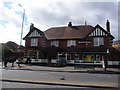
Redhill: horse and Horse and Jockey
I'm presuming that the jockey is inside!
Image: © Chris Downer
Taken: 8 Sep 2013
0.06 miles
4

Redhill: Castle Lane West
Castle Lane West and East from the A3060, a very busy road through the northern suburbs of Bournemouth. All is very quiet here, however, not just because we are in the midst of the coronavirus lockdown but also because it's a couple of minutes past 7 o'clock on Easter Sunday morning.
The road sign is a standard borough 1980s one, which must have been retained and reused on this railing because this junction was reconfigured in the early 90s, having previously been a mini-roundabout.
This is photo no.63 of a series of 453 in my coronavirus lockdown walking project:
See https://www.geograph.org.uk/article/My-2020-Coronavirus-Lockdown-walking-project for the complete set of photos.
Image: © Chris Downer
Taken: 12 Apr 2020
0.08 miles
5
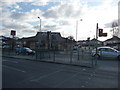
Bournemouth : Muscliff - Castle Lane West Pedestrian Crossing
When you cross the road you can go and have some pizza in the Pizza Hut if you wanted to.
Image: © Lewis Clarke
Taken: 11 Feb 2010
0.08 miles
6

Muscliff: Newmorton Road
Part of a small development of bungalows on this western side of Muscliffe Lane.
The slightly leaning sign is the standard Bournemouth nameplate from the 1980s, affixed with tubular steel which protrudes at each side.
This is photo no.291 of a series of 453 in my coronavirus lockdown walking project:
See https://www.geograph.org.uk/article/My-2020-Coronavirus-Lockdown-walking-project for the complete set of photos.
Image: © Chris Downer
Taken: 10 Apr 2020
0.08 miles
7
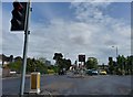
Bournemouth : Muscliff - Wimborne Road
Image: © Lewis Clarke
Taken: 27 Apr 2009
0.09 miles
8
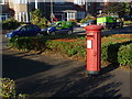
Redhill: the phone box has gone
Another view of Image, this time without its telephone neighbour. The phone box was removed in 2009 or 2010.
Image: © Chris Downer
Taken: 26 Jul 2013
0.09 miles
9
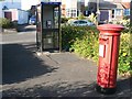
Redhill: postbox № BH10 74, Wimborne Road
This postbox stands on Wimborne Road, between the main carriageway and a parallel service road, outside № 1177.
Image: © Chris Downer
Taken: 30 Jun 2008
0.09 miles
10
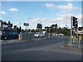
Bournemouth : Muscliff - Wimborne Road Junction
At the traffic lights Wimborne Road continues to the left, Castle Lane West is on the right side.
Image: © Lewis Clarke
Taken: 11 Feb 2010
0.09 miles