IMAGES TAKEN NEAR TO
Redbreast Road North, BOURNEMOUTH, BH9 3JF
Introduction
This page details the photographs taken nearby to Redbreast Road North, BH9 3JF by members of the Geograph project.
The Geograph project started in 2005 with the aim of publishing, organising and preserving representative images for every square kilometre of Great Britain, Ireland and the Isle of Man.

There are currently over 7.5m images from over14,400 individuals and you can help contribute to the project by visiting https://www.geograph.org.uk
Image Map
Images are licensed for reuse under creativecommons.org/licenses/by-sa/2.0
Notes
- Clicking on the map will re-center to the selected point.
- The higher the marker number, the further away the image location is from the centre of the postcode.
Image Listing (82 Images Found)
Images are licensed for reuse under creativecommons.org/licenses/by-sa/2.0
Image
Details
Distance
1
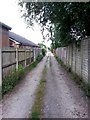
Moordown: Priory View Place heads east
Priory View Place is essentially a rear access lane to shops on Castle Lane West, between Priory View Road and Redbreast Road North, but it does have a couple of residential properties along it. It also forms public footpath M12.
Here, we look eastward from a short way in from the Redbreast end.
See Image for the next view along the lane ahead, and Image for the next view behind us, each with links to further views along the route.
Image: © Chris Downer
Taken: 10 Jul 2016
0.02 miles
2
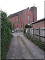
Moordown: western end of Priory View Place
Priory View Place is essentially a rear access lane to shops on Castle Lane West, between Priory View Road and Redbreast Road North, but it does have a couple of residential properties along it. It also forms public footpath M12.
Here, we look towards its western end, onto Redbreast Road North, with the Epiphany parish church looming large over us opposite.
See Image for the view towards us from the road ahead, and Image for the next view along the lane behind us, with links to further views along the route.
Image: © Chris Downer
Taken: 10 Jul 2016
0.02 miles
3
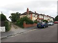
Moordown: Priory View Place leaves Redbreast Road North
Priory View Place is essentially a rear access lane to shops on Castle Lane West, between Priory View Road and Redbreast Road North, but it does have a couple of residential properties along it. It also forms public footpath M12. Here, we look along it from the Redbreast end.
See Image for the view towards us from a little way along the lane, and links to further views along the route.
Image: © Chris Downer
Taken: 10 Jul 2016
0.02 miles
4
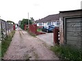
Moordown: passing 12 Priory View Place
Priory View Place is essentially a rear access lane to shops on Castle Lane West, between Priory View Road and Redbreast Road North, but it does have three residential properties along it. It also forms public footpath M12.
Here, we look eastward past the first of the three bungalows on the lane - slightly randomly, numbers 12 and 14 on the right and 19 on the left.
See Image for the next view along the lane ahead, and Image for the next view behind us, each with links to further views along the route.
Image: © Chris Downer
Taken: 10 Jul 2016
0.02 miles
5
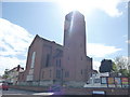
Bournemouth : Muscliff - Parish Church of the Holy Epiphany
Image: © Lewis Clarke
Taken: 27 Apr 2009
0.04 miles
6
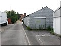
Moordown: a Rentokil parking space in Priory View Place
Priory View Place is essentially a rear access lane to shops on Castle Lane West, between Priory View Road and Redbreast Road North, but it does have a couple of residential properties along it. It also forms public footpath M12.
Here, we look westward along the lane, past the back yard of a premises occupied by several businesses, among them Rentokil.
See Image for the next view along the lane ahead, and Image for the next view behind us, each with links to further views along the route.
Image: © Chris Downer
Taken: 10 Jul 2016
0.04 miles
7
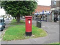
Muscliff: postbox № BH9 278, Castle Lane West
This postbox used to be a few hundred yards southwest of here, outside Priory View Road Post Office. However, a while after that closed in 2004, the shop it was within followed suit and was demolished to make way for flats, while the postbox was moved to its present position.
Image: © Chris Downer
Taken: 18 Jul 2008
0.04 miles
8
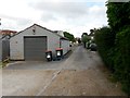
Moordown: Priory View Place goes from gravel to tarmac
Priory View Place is essentially a rear access lane to shops on Castle Lane West, between Priory View Road and Redbreast Road North, but it does have a couple of residential properties along it. It also forms public footpath M12.
Here, we are about halfway along, where the surface changes from gravel to tarmac.
See Image for the next view along the lane ahead, and Image for the next view behind us, each with links to further views along the route.
Image: © Chris Downer
Taken: 10 Jul 2016
0.04 miles