
IMAGES TAKEN NEAR TO
The Avenue, BOURNEMOUTH, BH9 2UX
Introduction
This page details the photographs taken nearby to The Avenue, BH9 2UX by members of the Geograph project.
The Geograph project started in 2005 with the aim of publishing, organising and preserving representative images for every square kilometre of Great Britain, Ireland and the Isle of Man.

There are currently over 7.5m images from over14,400 individuals and you can help contribute to the project by visiting https://www.geograph.org.uk
Image Map
Images are licensed for reuse under creativecommons.org/licenses/by-sa/2.0
Notes
- Clicking on the map will re-center to the selected point.
- The higher the marker number, the further away the image location is from the centre of the postcode.
Image Listing (98 Images Found)
Images are licensed for reuse under creativecommons.org/licenses/by-sa/2.0
Image
Details
Distance
1
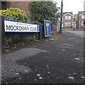
Moordown: Moordown Close
A small cul-de-sac of reasonably modern (1970s?) houses swinging around the corner behind the backs of houses on the main Wimborne Road.
The sign is a modern one - it is only in the last couple of years that Bournemouth Borough Council stopped including its name in smaller type at the top of the sign, perhaps in readiness for local government reorganisation in April 2019 which saw the borough council replaced by BCP (Bournemouth, Christchurch & Poole) council. The no-through-road sign incorporated within the nameplate is a fairly common arrangement, and the previous sign clearly didn't have one because the original accompanying sign remains alongside.
This is photo no.278 of a series of 453 in my coronavirus lockdown walking project:
See https://www.geograph.org.uk/article/My-2020-Coronavirus-Lockdown-walking-project for the complete set of photos.
Image: © Chris Downer
Taken: 17 Apr 2020
0.04 miles
2
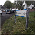
Moordown: Linden Road
A short one-segment road at the northern end of a long area of criss-cross roads on this western side of the main Wimborne Road, forming a series of squares. However, at this northern end, the three main north-south roads – Wimborne Road, The Avenue and The Grove sort of converge on one another, and Linden Road therefore runs in a quirky curve.
The fine detached houses that typify the whole area give way to bungalows on the northern side.
The road sign is a standard one from around 2000-2006, perhaps a little earlier, featuring the borough coat of arms.
This is photo no.244 of a series of 453 in my coronavirus lockdown walking project:
See https://www.geograph.org.uk/article/My-2020-Coronavirus-Lockdown-walking-project for the complete set of photos.
Image: © Chris Downer
Taken: 17 Apr 2020
0.05 miles
3
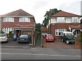
Moordown: footpath O11 to Redhill Common
One of three short public footpaths leading to Redhill Common from The Grove.
See Image for the view from the other end.
Image: © Chris Downer
Taken: 10 Jul 2016
0.05 miles
4
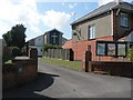
Moordown: Baptist church
Moordown Baptist Church is tucked away behind the houses of The Avenue (here) and The Grove (behind).
Image: © Chris Downer
Taken: 22 Jun 2008
0.06 miles
5
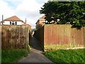
Redhill: footpath O11 to The Grove
This is one of three public footpaths arriving onto Redhill Common from The Grove. The extent of the public right of way is to the back garden walls, as the common is public land anyway.
See Image for the view along the path from the other end.
Image: © Chris Downer
Taken: 10 Jul 2016
0.06 miles
6
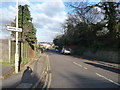
Bournemouth : Lawford Road
A road leading downhill towards Valette Road.
Image: © Lewis Clarke
Taken: 11 Feb 2010
0.06 miles
7
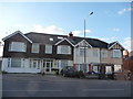
Bournemouth : Wimborne Road & Houses
Houses in front of one of the many signs which let us know we're on Wimborne Road.
Image: © Lewis Clarke
Taken: 11 Feb 2010
0.07 miles
8
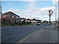
Bournemouth : Wimborne Road
A man is waiting eagerly on the opposite side of the road for his bus to come.
Image: © Lewis Clarke
Taken: 11 Feb 2010
0.07 miles
9
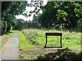
Redhill: entering the common from the north
Looking onto Image from the Portswood Drive entrance, in the northeastern corner of the common.
Image: © Chris Downer
Taken: 22 Jun 2008
0.08 miles
10
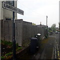
Moordown: Lawford Road
A short road which originally cut the corner between the major roads Wimborne Road and Castle Lane West, although the latter end has been closed to traffic since at least the early 1980s. It has a few houses on each side but this view is dominated by a tall fence for the flat above a former hairdresser's in the corner building.
The sign is the standard Bournemouth nameplate from the 1980s, more often seen close to ground level, affixed with tubular steel which protrudes at each side, but here attached high on a lamppost.
This is photo no.236 of a series of 453 in my coronavirus lockdown walking project:
See https://www.geograph.org.uk/article/My-2020-Coronavirus-Lockdown-walking-project for the complete set of photos.
Image: © Chris Downer
Taken: 17 Apr 2020
0.09 miles