
IMAGES TAKEN NEAR TO
Ashton Road, BOURNEMOUTH, BH9 2TW
Introduction
This page details the photographs taken nearby to Ashton Road, BH9 2TW by members of the Geograph project.
The Geograph project started in 2005 with the aim of publishing, organising and preserving representative images for every square kilometre of Great Britain, Ireland and the Isle of Man.

There are currently over 7.5m images from over14,400 individuals and you can help contribute to the project by visiting https://www.geograph.org.uk
Image Map
Images are licensed for reuse under creativecommons.org/licenses/by-sa/2.0
Notes
- Clicking on the map will re-center to the selected point.
- The higher the marker number, the further away the image location is from the centre of the postcode.
Image Listing (87 Images Found)
Images are licensed for reuse under creativecommons.org/licenses/by-sa/2.0
Image
Details
Distance
1
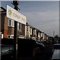
Moordown: Comley Road
This street of detached houses comes towards us from Elmes Road and comes to an end, with Delhi Road at 90º to our right.
The road sign is a standard one from around 2000-2006, perhaps a little earlier, featuring the borough coat of arms, but is an unframed version set high on a lamp post rather than the usual position on two posts.
This is photo no.80 of a series of 453 in my coronavirus lockdown walking project:
See https://www.geograph.org.uk/article/My-2020-Coronavirus-Lockdown-walking-project for the complete set of photos.
Image: © Chris Downer
Taken: 17 Apr 2020
0.06 miles
2
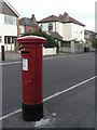
Moordown: postbox № BH9 247, Comley Road
This George V-reign postbox is by the corner of Comley and Middleton Roads.
Image: © Chris Downer
Taken: 10 Jul 2008
0.08 miles
3

Moordown: Middleton Road
A one-segment road running between the main Redhill Avenue (far end) and Comley Road, comprising desirable detached houses that are typical of hereabouts. The two bungalows visible to the right are probably infill developments in what used to be the longer back garden of the Comley Road corner house.
The road sign is a standard one from around 2000-2006 featuring the borough coat of arms.
This is photo no.270 of a series of 453 in my coronavirus lockdown walking project:
See https://www.geograph.org.uk/article/My-2020-Coronavirus-Lockdown-walking-project for the complete set of photos.
Image: © Chris Downer
Taken: 17 Apr 2020
0.09 miles
4
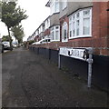
Moordown: Carey Road
Carey Road is one of the criss-cross roads of Moordown, with The Grove running up the west side, The Avenue up the middle, and the main Wimborne Road forming the east side.
Carey Road forms an exception, running parallel between The Grove and The Avenue for one segment, while all the others run east-west to form many squares.
All the roads have in common these desirable suburban detached houses.
The sign is of a simple design which was produced in great numbers, I believe at the back end of the 1980s, and quite a few remain.
This is photo no.59 of a series of 453 in my coronavirus lockdown walking project:
See https://www.geograph.org.uk/article/My-2020-Coronavirus-Lockdown-walking-project for the complete set of photos.
Image: © Chris Downer
Taken: 17 Apr 2020
0.10 miles
5
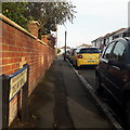
Redhill: Delhi Road
Looking along this side-road from Redhill Avenue, opposite Redhill Park. It is the northerly of the three 'prongs' forming a fork-shaped layout with Middleton Road the middle one and Elmes Road the southern one, which latter extends eastward to form the fork's handle. Comley Road runs at 90º and links the three roads.
No other roads in the area have an obvious Indian connection in their names, so I don't know how the name Delhi came about.
The houses are typical of the area - fine detached houses built in the earlier decades of the 20th century. The fact that we can only glimpse them tells its own story: the houses were built before off-road parking was a consideration.
The road sign is a standard one from around 2000-2006, perhaps a little earlier, featuring the borough coat of arms.
This is photo no.107 of a series of 453 in my coronavirus lockdown walking project:
See https://www.geograph.org.uk/article/My-2020-Coronavirus-Lockdown-walking-project for the complete set of photos.
Image: © Chris Downer
Taken: 17 Apr 2020
0.10 miles
6
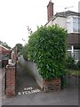
Moordown: footpath O03 to Redhill Common
One of three short public footpaths leading to Redhill Common from The Grove.
See Image for the view from the other end.
Image: © Chris Downer
Taken: 10 Jul 2016
0.11 miles
7
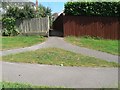
Redhill: footpath O03 from The Grove
This is one of three public footpaths arriving onto Redhill Common from The Grove. The extent of the public right of way is to the back garden walls, as the common is public land anyway.
See Image for the view along the path from the other end.
Image: © Chris Downer
Taken: 22 Jun 2008
0.11 miles
8
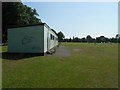
Redhill: playing field pavilion
The rather basic looking changing rooms on Image
Image: © Chris Downer
Taken: 22 Jun 2008
0.11 miles
9

Moordown: Kingdom Hall of Jehovah?s Witnesses
Tucked away in Elmes Road, otherwise a residential back street of Moordown.
Image: © Chris Downer
Taken: 10 Jul 2008
0.11 miles
10
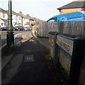
Moordown: Elmes Road
Looking along this long road of typical-for-Moordown early-20th-century detached houses, from its one junction, midway along, with Comley Road. Elmes Road does a slight kink at this junction, but not in the direction indicated by the curve of the pavement: immediately next to us, it swings back the other way and carries on a few degrees the other side of straight.
The road sign is a standard one from around 2000-2006, perhaps a little earlier, featuring the borough coat of arms. It is one of the earliest of these examples, with slightly broader typeface and with the name on a single line.
This is photo no.128 of a series of 453 in my coronavirus lockdown walking project:
See https://www.geograph.org.uk/article/My-2020-Coronavirus-Lockdown-walking-project for the complete set of photos.
Image: © Chris Downer
Taken: 17 Apr 2020
0.12 miles