
IMAGES TAKEN NEAR TO
The Grove, BOURNEMOUTH, BH9 2TT
Introduction
This page details the photographs taken nearby to The Grove, BH9 2TT by members of the Geograph project.
The Geograph project started in 2005 with the aim of publishing, organising and preserving representative images for every square kilometre of Great Britain, Ireland and the Isle of Man.

There are currently over 7.5m images from over14,400 individuals and you can help contribute to the project by visiting https://www.geograph.org.uk
Image Map
Images are licensed for reuse under creativecommons.org/licenses/by-sa/2.0
Notes
- Clicking on the map will re-center to the selected point.
- The higher the marker number, the further away the image location is from the centre of the postcode.
Image Listing (95 Images Found)
Images are licensed for reuse under creativecommons.org/licenses/by-sa/2.0
Image
Details
Distance
1
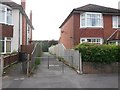
Moordown: footpath O04 to Redhill Common
The widest of the three short public footpaths leading to Redhill Common from The Grove.
See Image for the view from the other end.
Image: © Chris Downer
Taken: 10 Jul 2016
0.02 miles
2
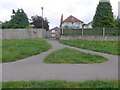
Redhill: footpath O04 from The Grove
This is the widest and middle of the three public footpaths arriving onto Redhill Common from The Grove. The extent of the public right of way is to the back garden walls, as the common is public land anyway.
See Image for the view along the path from the other end.
Image: © Chris Downer
Taken: 10 Jul 2016
0.02 miles
3
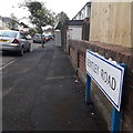
Moordown: Bentley Road
This short road of well-to-do detached houses is one of numerous in a criss-cross pattern, at right angles to Wimborne Road, The Avenue and The Grove. It is one of the shorter ones, with only one segment – terminating on The Avenue rather than crossing it.
The sign is of a design that became prevalent in Bournemouth around 1990 and was in use for most of that decade. Many are starting to look a bit shabby now, but this one is in good condition without any peeling white or fading blue.
This is photo no.35 of a series of 451 in my coronavirus lockdown walking project:
See https://www.geograph.org.uk/article/My-2020-Coronavirus-Lockdown-walking-project for the complete set of photos.
Image: © Chris Downer
Taken: 17 Apr 2020
0.03 miles
4
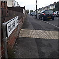
Moordown: Barrie Road
One of a series of short roads running west-east from The Grove, over The Avenue to Wimborne Road, in a large-ish area of desirable detached houses. This one of only a couple that does both segments.
The sign is a typical 70s/80s Bournemouth nameplate mounted on tubular steel which protrudes at each end.
This is photo no.30 of a series of 451 in my coronavirus lockdown walking project:
See https://www.geograph.org.uk/article/My-2020-Coronavirus-Lockdown-walking-project for the complete set of photos.
Image: © Chris Downer
Taken: 17 Apr 2020
0.03 miles
5
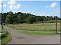
Redhill: The Dell
According to a map on a noticeboard on Image, this small area immediately to the east of the Image (visible far left) is called The Dell.
Image: © Chris Downer
Taken: 22 Jun 2008
0.04 miles
6
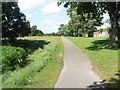
Redhill: Grove Green
The mown eastern section of Image, containing the paved path, is called Grove Green, being alongside The Grove, whose even-numbered houses back onto it.
Image: © Chris Downer
Taken: 22 Jun 2008
0.05 miles
7
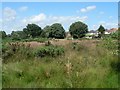
Redhill: looking across the common
A view across Image towards the even-numbered houses of The Grove, which back onto it.
Image: © Chris Downer
Taken: 22 Jun 2008
0.06 miles
8
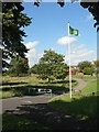
Redhill: Redhill Common nature reserve
Redhill Common was protected from development by the Christchurch Inclosures Act, which was passed by parliament in 1802. Since that time, the surrounding areas have been much developed with housing while this remains a peaceful retreat.
It has been awarded the Green Flag for 2007-08, an initiative that recognises exceptional public spaces.
Image: © Chris Downer
Taken: 22 Jun 2008
0.07 miles
9
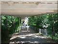
Redhill: under the footbridge
A view underneath Image
Image: © Chris Downer
Taken: 22 Jun 2008
0.07 miles
10
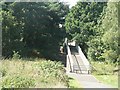
Redhill: footbridge over Redhill Avenue
Image: © Chris Downer
Taken: 22 Jun 2008
0.07 miles