
IMAGES TAKEN NEAR TO
Victoria Park Road, BOURNEMOUTH, BH9 2RE
Introduction
This page details the photographs taken nearby to Victoria Park Road, BH9 2RE by members of the Geograph project.
The Geograph project started in 2005 with the aim of publishing, organising and preserving representative images for every square kilometre of Great Britain, Ireland and the Isle of Man.

There are currently over 7.5m images from over14,400 individuals and you can help contribute to the project by visiting https://www.geograph.org.uk
Image Map
Images are licensed for reuse under creativecommons.org/licenses/by-sa/2.0
Notes
- Clicking on the map will re-center to the selected point.
- The higher the marker number, the further away the image location is from the centre of the postcode.
Image Listing (106 Images Found)
Images are licensed for reuse under creativecommons.org/licenses/by-sa/2.0
Image
Details
Distance
1
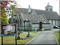
Church, Moordown
This is the Parish Church of St. John the Baptist, Moordown. It is situated on the main road through Moordown, a suburb of Bournemouth.
Image: © Stuart Buchan
Taken: 13 Oct 2005
0.02 miles
2
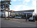
Bournemouth : Moordown - Brake & Clutch Depot
If your brakes don't work or you need a new clutch, if you go by names of businesses, then this would be the ideal place for you.
Image: © Lewis Clarke
Taken: 11 Feb 2010
0.02 miles
3
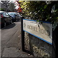
Winton: Edgehill Road
Looking around the corner into Edgehill Road from its northern end. We don't see much of the detached houses from the earlier part of the 20th century, but we do see that there are far more cars now than were accommodated for when they were built. While many have driveways, lots of families now have two or three cars, of course.
The road sign is a standard one from around 2000-2006, perhaps a little earlier, featuring the borough coat of arms.
This is photo no.123 of a series of 453 in my coronavirus lockdown walking project:
See https://www.geograph.org.uk/article/My-2020-Coronavirus-Lockdown-walking-project for the complete set of photos.
Image: © Chris Downer
Taken: 10 Apr 2020
0.03 miles
4
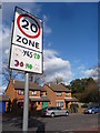
Bournemouth : Winton - Victoria Park Road & Speed Sign
A nicely decorated sign - 20 yes, and gets a happy face. 30 no, and it's all very sad.
Image: © Lewis Clarke
Taken: 11 Feb 2010
0.03 miles
5
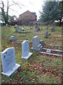
Bournemouth : Moordown - St. John the Baptist Gravestones
Gravestones are all unique and come in different shapes and sizes. Maybe one day somebody will take a photo and geograph my own gravestone.
Image: © Lewis Clarke
Taken: 11 Feb 2010
0.03 miles
6
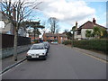
Bournemouth : Winton - Edgehill Road
Getting towards the end of the road and the junction with Victoria Park Road.
Image: © Lewis Clarke
Taken: 11 Feb 2010
0.03 miles
7
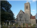
Bournemouth : Moordown - Parish Church of St. John the Baptist
A church in Moordown and the surrounding gravestones in the churchyard at 3.40pm.
Image: © Lewis Clarke
Taken: 11 Feb 2010
0.03 miles
8
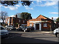
Bournemouth : Winton - Rooper Memorial Hall
The hall on Victoria Park Road is used for ballroom dancing and functions.
Image: © Lewis Clarke
Taken: 11 Feb 2010
0.04 miles
9
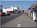
Bournemouth : Winton, Wimborne Road
The laptop repair shop here has relocated. The 5a yellow bus is in the background and there's also a junction into Jameson Road.
Image: © Lewis Clarke
Taken: 20 Mar 2009
0.04 miles
10
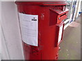
Winton: postbox with restricted slot width
The notice, affixed to the side of Image on January 30, explains that following attacks on this box with fireworks over the last few years, the aperture has been narrowed to restrict what can be inserted. This aims to discourage such interference and the restriction will be removed when it is felt that the threat to this box and its contents is no longer an issue.
In the mean time, details are given of the nearest points where larger items can be posted.
Image: © Chris Downer
Taken: 1 Feb 2009
0.04 miles