1
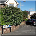
Winton: Lampton Gardens
An infill development dating from around 2000 (slight guesswork here), taking in the rear workshop/yard area of the former Caffyns Fiat dealership on the main Wimborne Road.
The road sign is a standard one from around 2000-2006 featuring the borough coat of arms and, in this case, incorporating a no-through road sign.
This is photo no.235 of a series of 453 in my coronavirus lockdown walking project:
See https://www.geograph.org.uk/article/My-2020-Coronavirus-Lockdown-walking-project for the complete set of photos.
Image: © Chris Downer
Taken: 13 May 2020
0.02 miles
2
Bournemouth : Winton - Edgehill Road
Getting towards the end of the road and the junction with Victoria Park Road.
Image: © Lewis Clarke
Taken: 11 Feb 2010
0.03 miles
3
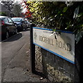
Winton: Edgehill Road
Looking around the corner into Edgehill Road from its northern end. We don't see much of the detached houses from the earlier part of the 20th century, but we do see that there are far more cars now than were accommodated for when they were built. While many have driveways, lots of families now have two or three cars, of course.
The road sign is a standard one from around 2000-2006, perhaps a little earlier, featuring the borough coat of arms.
This is photo no.123 of a series of 453 in my coronavirus lockdown walking project:
See https://www.geograph.org.uk/article/My-2020-Coronavirus-Lockdown-walking-project for the complete set of photos.
Image: © Chris Downer
Taken: 10 Apr 2020
0.04 miles
4
Twenty?s plenty
A schoolchild's drawing of a tortoise accompanies this sign at a 20mph speed reduction scheme near a school – Moordown St. John's CE Primary School is the building in the distance.
Image: © Chris Downer
Taken: 23 Jun 2007
0.05 miles
5
Bournemouth : Winton - Rooper Memorial Hall
The hall on Victoria Park Road is used for ballroom dancing and functions.
Image: © Lewis Clarke
Taken: 11 Feb 2010
0.05 miles
6
Bournemouth : Winton - Victoria Park Road & Speed Sign
A nicely decorated sign - 20 yes, and gets a happy face. 30 no, and it's all very sad.
Image: © Lewis Clarke
Taken: 11 Feb 2010
0.05 miles
7
Bournemouth : Winton - Edgehill Road
On the road junction with Jameson Road looking forward at Edgehill Road.
Image: © Lewis Clarke
Taken: 11 Feb 2010
0.06 miles
8
Moordown: Bournemouth Society for the Visually Impaired
This local charity was originally set up as the Bournemouth Blind Aid Society in the first decade of the 1900s. The wing to the left was living accommodation for about ten blind women. It is now a thriving charity, with some 600 members on its books and runs daily events such as cribbage sessions, bowling and chiropody, as well as a monthly newsletter on cassette and a shop selling visual aids of all sorts, from simple things like bumpy stickers for remote control buttons to television magnifying equipment to large print board games to speech software for pcs.
The right-hand wing is the Rooper Memorial Hall, which is bookable by line-dancing groups and other such organisations, and is named after one of the charity's chief committeemen of the 1940s.
Image: © Chris Downer
Taken: 1 Mar 2008
0.06 miles
9
Winton: YMCA
It is highly unusual for the YMCA to have a branch in such a non-town centre location. Winton YMCA was built in 1927, replacing a more primitive building nearby, according to a former billiards player whom I talked to, who was a member of the Winton YMCA billiards team that won the local league title in the season 1926-27.
Image: © Chris Downer
Taken: 1 Mar 2008
0.07 miles
10
Winton: Victoria Parade
So named in decaying stonework either side of the centrepiece, this used to be a cinema but closed down in 1959. It comprises nos. 688-702 Wimborne Road. The camera shop with the postbox outside used to house Castle Road Post Office (named after the road that comes out opposite it), which closed down on 6 March 2004.
The history of the cinema is told here: http://www.wintonforum.co.uk/cinemas.html
Image: © Chris Downer
Taken: 1 Mar 2008
0.07 miles


