1
Winton: Victoria Parade
So named in decaying stonework either side of the centrepiece, this used to be a cinema but closed down in 1959. It comprises nos. 688-702 Wimborne Road. The camera shop with the postbox outside used to house Castle Road Post Office (named after the road that comes out opposite it), which closed down on 6 March 2004.
The history of the cinema is told here: http://www.wintonforum.co.uk/cinemas.html
Image: © Chris Downer
Taken: 1 Mar 2008
0.02 miles
2
Winton: Lampton Gardens
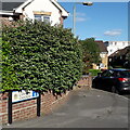
An infill development dating from around 2000 (slight guesswork here), taking in the rear workshop/yard area of the former Caffyns Fiat dealership on the main Wimborne Road.
The road sign is a standard one from around 2000-2006 featuring the borough coat of arms and, in this case, incorporating a no-through road sign.
This is photo no.235 of a series of 453 in my coronavirus lockdown walking project:
See https://www.geograph.org.uk/article/My-2020-Coronavirus-Lockdown-walking-project for the complete set of photos.
Image: © Chris Downer
Taken: 13 May 2020
0.03 miles
3
Winton: postbox № BH9 103, Wimborne Road
A large, Elizabeth II-reign postbox outside a camera shop which was also Castle Road Post Office until its closure on 6 March 2004. It is in
Image
Image: © Chris Downer
Taken: 6 Jul 2008
0.03 miles
4
Winton: postbox with restricted slot width
The notice, affixed to the side of
Image on January 30, explains that following attacks on this box with fireworks over the last few years, the aperture has been narrowed to restrict what can be inserted. This aims to discourage such interference and the restriction will be removed when it is felt that the threat to this box and its contents is no longer an issue.
In the mean time, details are given of the nearest points where larger items can be posted.
Image: © Chris Downer
Taken: 1 Feb 2009
0.03 miles
5
Bournemouth : Winton, Wimborne Road Postbox
A post box on Wimborne Road which has been the victim of vandalism - there is a sign saying it's been closed up due to people putting fireworks in post.
Image: © Lewis Clarke
Taken: 20 Mar 2009
0.04 miles
6
Bournemouth : Winton - Edgehill Road
Getting towards the end of the road and the junction with Victoria Park Road.
Image: © Lewis Clarke
Taken: 11 Feb 2010
0.04 miles
7
Winton: Edgehill Road
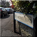
Looking around the corner into Edgehill Road from its northern end. We don't see much of the detached houses from the earlier part of the 20th century, but we do see that there are far more cars now than were accommodated for when they were built. While many have driveways, lots of families now have two or three cars, of course.
The road sign is a standard one from around 2000-2006, perhaps a little earlier, featuring the borough coat of arms.
This is photo no.123 of a series of 453 in my coronavirus lockdown walking project:
See https://www.geograph.org.uk/article/My-2020-Coronavirus-Lockdown-walking-project for the complete set of photos.
Image: © Chris Downer
Taken: 10 Apr 2020
0.04 miles
8
Winton: Christmas cracker
The Christmas lights in Winton denote several festive objects such as a star, robin, tree, stocking and – as seen here – a Christmas cracker.
A glowing candle can be seen on the next lamppost along, and a Santa Claus can be discerned in the distance across the road.
Image: © Chris Downer
Taken: 25 Dec 2007
0.04 miles
9
Church, Moordown
This is the Parish Church of St. John the Baptist, Moordown. It is situated on the main road through Moordown, a suburb of Bournemouth.
Image: © Stuart Buchan
Taken: 13 Oct 2005
0.05 miles
10
Winton, undertakers
W.Smith & Sons, on Wimborne Road; founded 1892, as carriage works, wheelwrights & undertakers. http://www.dorsetfunerals.co.uk/company.php
Image: © Mike Faherty
Taken: 26 May 2009
0.05 miles


