
IMAGES TAKEN NEAR TO
Wimborne Road, BOURNEMOUTH, BH9 2AF
Introduction
This page details the photographs taken nearby to Wimborne Road, BH9 2AF by members of the Geograph project.
The Geograph project started in 2005 with the aim of publishing, organising and preserving representative images for every square kilometre of Great Britain, Ireland and the Isle of Man.

There are currently over 7.5m images from over14,400 individuals and you can help contribute to the project by visiting https://www.geograph.org.uk
Image Map
Images are licensed for reuse under creativecommons.org/licenses/by-sa/2.0
Notes
- Clicking on the map will re-center to the selected point.
- The higher the marker number, the further away the image location is from the centre of the postcode.
Image Listing (133 Images Found)
Images are licensed for reuse under creativecommons.org/licenses/by-sa/2.0
Image
Details
Distance
1
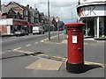
Winton: postbox № BH9 97, Wimborne Road
A large postbox on the busy junction, Image We look north beyond it up Wimborne Road – see Image Crimea Road is to the right.
Image: © Chris Downer
Taken: 6 Jul 2008
0.01 miles
4
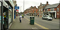
Bournemouth : Winton, Wimborne Road
Wimborne Road in Winton. In this picture Lloyds TSB and Natwest banks can be seen as well as Beau, Rhapsody Coffee and Sambuca Italian Restaurant can be seen.
Image: © Lewis Clarke
Taken: 13 Mar 2009
0.02 miles
5
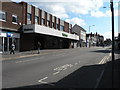
Winton: Waitrose
The Waitrose store is at 355 Wimborne Road – Winton’s main shopping street. It was formerly occupied by Boot’s the Chemist until the early 80s, when they moved to their present premises – Image – outside which we are stood now.
Image: © Chris Downer
Taken: 23 Mar 2008
0.03 miles
6
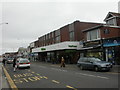
Winton, Waitrose
Supermarket near the Southern end of Wimborne Road http://www.waitrose.com/branches/branchdetails.aspx?uid=161
Image: © Mike Faherty
Taken: 26 Mar 2009
0.03 miles
7
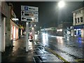
Winton: car park signage on Wimborne Road
Just north of Image on the main road through Winton, this sign indicates the availability of spaces at the two main car parks. Leslie Road is next left, while Cranmer Road is perhaps a quarter of a mile further on. Needless to say there are plenty of spaces available at almost 9 o'clock in the evening.
Image: © Chris Downer
Taken: 31 Jan 2017
0.03 miles
8
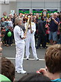
Winton: Olympic flame handover
Morag Day (see Image) poses for a photo with her successor torch-bearer as the flame has been transferred from one torch to the next, outside the Lloyds TSB bank in Winton.
Unfortunately I have not found a list of torch bearers in order of appearance, so I cannot report the identity of the young lady who carried the torch from here along Alma Road.
Image: © Chris Downer
Taken: 13 Jul 2012
0.03 miles
9
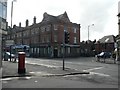
Winton: Winton Banks
This busy road junction in Winton is called Winton Banks thanks to the banks that used to occupy either corner of Talbot Road (right). Now, the NatWest prominent in this picture is the only one remaining – for more discussion, see Image
Image: © Chris Downer
Taken: 23 Mar 2008
0.03 miles
10
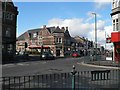
Winton: former Lloyd?s Bank
The former Lloyd’s, along with the NatWest to the left, give this busy road junction in Winton the name of Image – although the Barclays is at the next junction south and the HSBC farther north. The Lloyd’s closed when it merged with TSB and the latter was retained almost opposite.
The old bank became a restaurant ironically called Barings before being taken over by the present Indian restaurant.
Image: © Chris Downer
Taken: 23 Mar 2008
0.03 miles