
IMAGES TAKEN NEAR TO
Evelyn Mews, BOURNEMOUTH, BH9 1TA
Introduction
This page details the photographs taken nearby to Evelyn Mews, BH9 1TA by members of the Geograph project.
The Geograph project started in 2005 with the aim of publishing, organising and preserving representative images for every square kilometre of Great Britain, Ireland and the Isle of Man.

There are currently over 7.5m images from over14,400 individuals and you can help contribute to the project by visiting https://www.geograph.org.uk
Image Map
Images are licensed for reuse under creativecommons.org/licenses/by-sa/2.0
Notes
- Clicking on the map will re-center to the selected point.
- The higher the marker number, the further away the image location is from the centre of the postcode.
Image Listing (107 Images Found)
Images are licensed for reuse under creativecommons.org/licenses/by-sa/2.0
Image
Details
Distance
1
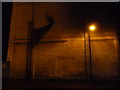
Moordown: a shadow of the wind
It was blowing a gale tonight and the Union Jack outside Moordown Conservative Club was flapping gaily - its shadow is being cast on the large wall opposite.
The wall is the rear of the side, so to speak, of the Moordown Life Centre - see Image for the front of the building.
See Image for a wider view including the flag itself.
Image: © Chris Downer
Taken: 4 Feb 2014
0.05 miles
2
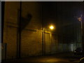
Moordown: Balfour Road on a windy night
Balfour Road is a narrow side-street, little more than an alley, off the main Wimborne Road alongside the Life Centre (see Image]), whose side wall we are viewing here.
The Union Jack is outside the Moordown Conservative Club and, in tonight's very windy weather, it is creating a large, almost surreal shadow on the wall thanks to a nearby floodlight for the club's car park.
Image: © Chris Downer
Taken: 4 Feb 2014
0.05 miles
3
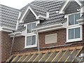
As contemporary as you can get
This dwelling in Muscliffe Road, Moordown, is just nearing completion and has been adorned with a date stone for 2007 – the first one I have seen.
Image: © Chris Downer
Taken: 15 Jul 2007
0.07 miles
4
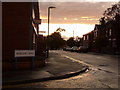
Winton: Castle Road
Looking along the western half of Castle Road from the Muscliffe Road crossroads. After an overcast and drizzly day, the sun finally decided to make an appearance at about 8pm, from under the immediate cloud cover.
Image: © Chris Downer
Taken: 29 Jul 2009
0.08 miles
5

Moordown: Moorfield Grove
One of the typical residential streets in Winton and Moordown, with its early 20th-century houses, Moorfield Grove is nevertheless slightly unusual in coming to an abrupt stop, at the back of what was originally the grounds of Winton Boys' School, a community centre and sheltered housing since the school moved to more modern premises in the late 1990s.
It is also unusual in having no road nameplate: it did until fairly recently but must have been the victim of vandalism or traffic collision.
This is photo no.280 of a series of 453 in my coronavirus lockdown walking project:
See https://www.geograph.org.uk/article/My-2020-Coronavirus-Lockdown-walking-project for the complete set of photos.
Image: © Chris Downer
Taken: 12 Apr 2020
0.08 miles
6
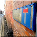
Moordown: Balfour Road
Balfour Road is a strange little road - it appears little more than a rear access alleyway between shops on the main Wimborne Road. But it in fact leads down to Moordown Conservative Club and has a few houses beyond.
The sign is a nonstandard version of the standard Bournemouth one from around 2000, with the borough coat of arms at the left, but it does not have BOURNEMOUTH BOROUGH COUNCIL in smaller print at the top, which is usual. PRIVATE RD is, though, added at the bottom.
This is photo no.25 of a series of 451 in my coronavirus lockdown walking project:
See https://www.geograph.org.uk/article/My-2020-Coronavirus-Lockdown-walking-project for the complete set of photos.
Image: © Chris Downer
Taken: 10 Apr 2020
0.08 miles
7

Moordown: the Moderne
This building was originally a cinema, but became the Moderne social club around 1970 and was later taken over by the Gala bingo hall chain. It closed in late February 2008.
The small frontage belies the size of the premises, which can be realised by looking at the large grey section beyond, including into the very far right of the picture behind the red-brick gable in the foreground.
The history of the cinema is told on the Winton Community website here http://www.wintonforum.co.uk/cinemas.html and here http://www.wintonforum.co.uk/modernememories.html
Image: © Chris Downer
Taken: 1 Mar 2008
0.08 miles
8
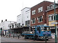
Moordown: the Moderne scaffolding comes down
The facelift of the former Image bingo hall is nearing completion and the scaffolding is being dismantled, revealing the work that has gone on to reproduce its original art-deco look. The building will fairly soon start its new lease of life as a church and community centre.
Image: © Chris Downer
Taken: 7 Jul 2010
0.09 miles
9
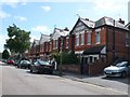
Coronation Avenue Bournemouth
View east along this quiet residential street of solidly built victorian red brick houses.
Image: © Nigel Mykura
Taken: 28 Aug 2009
0.09 miles
10
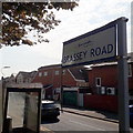
Winton: Brassey Road
One of the densely packed, early 20th century roads containing mainly detached houses with no off-road parking, Brassey Road is seen here from its junction with the main shopping street, Wimborne Road.
It is only the first hundred yards or so which falls within my 2km radius.
The sign is of the design dating from about 2009 when the modern emblem was adopted as a working logo for the council, in place of the borough coat of arms. It is a double-sided sign rather than the usual low-level version on two legs.
This is photo no.46 of a series of 453 in my coronavirus lockdown walking project:
See https://www.geograph.org.uk/article/My-2020-Coronavirus-Lockdown-walking-project for the complete set of photos.
Image: © Chris Downer
Taken: 10 Apr 2020
0.09 miles