
IMAGES TAKEN NEAR TO
Pine Road, BOURNEMOUTH, BH9 1NA
Introduction
This page details the photographs taken nearby to Pine Road, BH9 1NA by members of the Geograph project.
The Geograph project started in 2005 with the aim of publishing, organising and preserving representative images for every square kilometre of Great Britain, Ireland and the Isle of Man.

There are currently over 7.5m images from over14,400 individuals and you can help contribute to the project by visiting https://www.geograph.org.uk
Image Map
Images are licensed for reuse under creativecommons.org/licenses/by-sa/2.0
Notes
- Clicking on the map will re-center to the selected point.
- The higher the marker number, the further away the image location is from the centre of the postcode.
Image Listing (150 Images Found)
Images are licensed for reuse under creativecommons.org/licenses/by-sa/2.0
Image
Details
Distance
1
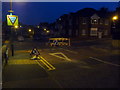
Winton: squareabout in Pine Road
Roadworks by the gas board have produced this temporary roundabout-type junction where Pine (left-right) and Muscliff Roads meet. Motorists driving anything but the most standard of cars will have quite a tight manoeuvre to make some of the right turns.
Image: © Chris Downer
Taken: 26 May 2010
0.05 miles
2
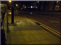
Winton: slushy pavements
The big freeze of the last couple of days is gradually turning into the slow thaw. The considerable snow is starting to melt as fresh falls turn into hail and sleet. It is about 9 o’clock and there is hardly anyone about – fortunately, because you are deploying a peculiar gait which is difficult to achieve and difficult to describe. Each footstep creates a squelchy sound and an imprint behind. The newly melted water creates a constant trickling sound as it flows into drains – this and soft thuds from small lumps of semi-thawed snow falling from roofs and cars are the only sounds that join one’s footsteps in breaking the silence: it brings to my mind the atmosphere of being in an ill-lit cave. The texture of the slush on the roads is similar to that of the road surface, so when you step out to cross the road you sink half an inch lower than you thought you would. This is not a night for wearing those jeans that are really just that ½ inch too long for you, and when a car approaches you give it a wide berth lest you get sprinkled with cold, muddy sleet.
All that to pop out to buy the paper.
Image: © Chris Downer
Taken: 3 Feb 2009
0.06 miles
3
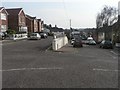
Winton: split level section of Calvin Road
The hilly terrain around here is overcome in Calvin Road with a dead-end section and the through section, separated by an ever-heightening wall.
Image: © Chris Downer
Taken: 24 Feb 2008
0.06 miles
4
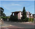
Winton: a pink house is demolished
This house, on the corner of Muscliffe and Pine Roads, is about to be demolished – probably to make way for more flats.
Image: © Chris Downer
Taken: 11 May 2008
0.06 miles
5
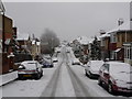
Winton: snow in Muscliffe Road
This section of Muscliffe Road consists of a steepish descent followed by a similar ascent, and would have been quite hazardous just now.
This burst of snowfall was surprising, since it had started rainy this morning. This picture was taken at 11:49am, by which time the snowfall had been going on for a couple of hours. By nightfall, the main carriageways of all the roads were clear of snow and ice, making this the severest snowfall I think I have ever seen that had started and almost disappeared all on the same day.
Throughout the day, the BBC weather forecast suggested temperatures of about 2ºC and 'light rain'.
Image: © Chris Downer
Taken: 6 Feb 2009
0.07 miles
6
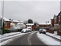
Winton: Muscliffe Road meets Calvin Road
Looking down the southernmost section of Muscliffe Road, which breaks the standard criss-cross pattern of roads by veering to the right on its way downhill. It continues up the other side, back parallel with its neighbours, as Ridley Road. Calvin Road crosses in the dip, behind the white van.
Two days after heavy snow earlier in the week had all thawed, this fresh lot fell from the north this morning, despite the fact that the day started rainy, with large puddles all around.
By nightfall, the main carriageways of all roads were clear of snow and ice, so this was a very heavy fall considering that it started and had almost disappeared on the same day.
Image: © Chris Downer
Taken: 6 Feb 2009
0.07 miles
7
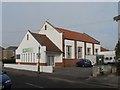
Winton: Bournemouth Community Church Centre
Situated in Calvin Road, according to the 1975 Kelly's Directory this was then the Winton Free Evangelical Church. It is now Bournemouth Community Church Centre, and in fairly recent years the porch section has been added, rather pleasingly mirroring the original façade.
Image: © Chris Downer
Taken: 24 Feb 2008
0.08 miles
8
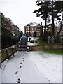
Winton: steps to Pine Road Rec
These steps lead down from Pine Road into Image
Image: © Chris Downer
Taken: 6 Feb 2009
0.08 miles
9
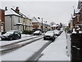
Winton: snow in Calvin Road
Two days after heavy snow earlier in the week had all thawed, this fresh lot fell from the north this morning, despite the fact that the day started rainy, with large puddles all around.
By nightfall, the main carriageways of all roads were clear of snow and ice, so this was a very heavy fall considering that it started and had almost disappeared on the same day.
Image: © Chris Downer
Taken: 6 Feb 2009
0.09 miles
10
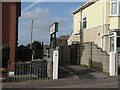
Winton: Apostolic Faith Church entranceway
The driveway to the Image, between 64 and 68 Muscliffe Road. The sign says "APOSTOLIC FAITH CHURCH International Headquarters EMMANUEL HALL".
At the end of the driveway can be seen the signboard of the Hutchinson Memorial Hall.
For more discussion of the building, see the Winton Community Forum page here: http://www.wintonforum.co.uk/apostolicfaithchurch.html
Image: © Chris Downer
Taken: 2 Mar 2008
0.10 miles