
IMAGES TAKEN NEAR TO
Markham Road, BOURNEMOUTH, BH9 1HZ
Introduction
This page details the photographs taken nearby to Markham Road, BH9 1HZ by members of the Geograph project.
The Geograph project started in 2005 with the aim of publishing, organising and preserving representative images for every square kilometre of Great Britain, Ireland and the Isle of Man.

There are currently over 7.5m images from over14,400 individuals and you can help contribute to the project by visiting https://www.geograph.org.uk
Image Map
Images are licensed for reuse under creativecommons.org/licenses/by-sa/2.0
Notes
- Clicking on the map will re-center to the selected point.
- The higher the marker number, the further away the image location is from the centre of the postcode.
Image Listing (61 Images Found)
Images are licensed for reuse under creativecommons.org/licenses/by-sa/2.0
Image
Details
Distance
1
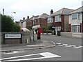
Winton: postbox № BH9 121, Markham Road
An Edward VII-reign box in Markham Road, close to the crossroads with Somerley Road – two roads pretty typical of this part of Bournemouth.
Image: © Chris Downer
Taken: 4 Jul 2008
0.07 miles
2
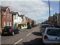
Charminster, Hankinson Road
Mixed Edwardian houses in a road named after Bournemouth's first mayor, Thomas James Hankinson, previously chairman of the Bournemouth Commissioners, later mayor of Bournemouth Borough Council from 1890. http://www.bournemouth.gov.uk/Residents/Historical_Bournemouth/council_history.asp
Image: © Mike Faherty
Taken: 28 Mar 2009
0.08 miles
3
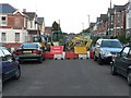
Winton: Green Road undergoes work
Major maintenance work in Green Road has closed the road from April to June 2008. This part, through housing built before the need for off-road parking was foreseen, is a tricky part for bus drivers on the route 24, which does a left turn followed shortly by a right (following the yellow road on the map), and queues often occur, short in terms of length but long in terms of time. The current diversion is no easier.
Image: © Chris Downer
Taken: 14 Apr 2008
0.10 miles
4
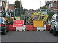
No parking beyond this point...
A close up of the signs accompanying these roadworks (see Image). I would like to see someone try to park beyond that point!
Image: © Chris Downer
Taken: 14 Apr 2008
0.10 miles
5
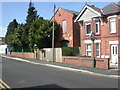
Charminster, sub-station
Well disguised electricity sub-station, behind a brick facade, at the junction of Green & Abbott Roads.
Image: © Mike Faherty
Taken: 28 Mar 2009
0.10 miles
6
Bournemouth : Winton - Heron Court Road
Looking towards the side of Winton Rec with the road junction at Maxwell Road.
Image: © Lewis Clarke
Taken: 5 Oct 2010
0.13 miles
7
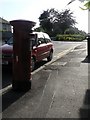
Winton: postbox № BH9 174, Maxwell Road
This Elizabeth II-reign postbox is in Maxwell Road, opposite Image and close to the junction with Heron Court Road, which can be seen beyond.
Image: © Chris Downer
Taken: 25 Jun 2008
0.14 miles
8
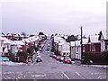
Winton: snowy rooftops
Looking down Murley Road, which turns into Frampton Road in the bottom of the dip, with white rooftops all around.
Two days after heavy snow earlier in the week had all thawed, this fresh lot fell from the north this morning, despite the fact that the day started rainy, with large puddles all around.
By nightfall, the main carriageways of all roads were clear of snow and ice, so this was a very heavy fall considering that it started and had almost disappeared on the same day.
Image: © Chris Downer
Taken: 6 Feb 2009
0.14 miles
9
Winton: Truscott Avenue
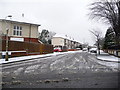
In a fit of dare, Truscott Avenue breaks with the traditional criss-cross pattern of neighbouring roads, and crosses them diagonally for no apparent reason.
Two days after heavy snow earlier in the week had all thawed, this fresh lot fell from the north this morning, despite the fact that the day started rainy, with large puddles all around.
By nightfall, the main carriageways of all roads were clear of snow and ice, so this was a very heavy fall considering that it started and had almost disappeared on the same day.
Image: © Chris Downer
Taken: 6 Feb 2009
0.14 miles
10
Winton: postbox № BH9 195, Frampton Road
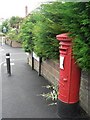
This George V-reign postbox serves typical Bournemouth suburbia, and is in Frampton Road close to its junction with Green Road (left to right) and Murley Road (seen in the distance).
Image: © Chris Downer
Taken: 12 Jul 2008
0.14 miles