
IMAGES TAKEN NEAR TO
Castle Lane West, BOURNEMOUTH, BH8 9UG
Introduction
This page details the photographs taken nearby to Castle Lane West, BH8 9UG by members of the Geograph project.
The Geograph project started in 2005 with the aim of publishing, organising and preserving representative images for every square kilometre of Great Britain, Ireland and the Isle of Man.

There are currently over 7.5m images from over14,400 individuals and you can help contribute to the project by visiting https://www.geograph.org.uk
Image Map
Images are licensed for reuse under creativecommons.org/licenses/by-sa/2.0
Notes
- Clicking on the map will re-center to the selected point.
- The higher the marker number, the further away the image location is from the centre of the postcode.
Image Listing (51 Images Found)
Images are licensed for reuse under creativecommons.org/licenses/by-sa/2.0
Image
Details
Distance
1
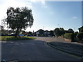
Bournemouth : Ibbertson Road & Castle Lane West
A road left and right to join Castle Lane West.
Image: © Lewis Clarke
Taken: 16 Oct 2009
0.04 miles
2
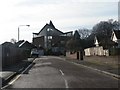
Strouden: Craigmoor Close and St. Barnabas
Looking along this quiet residential cul-de-sac, with the impressive Image, whose entrance is on Mount Pleasant Drive, around the other side and on considerably higher ground.
Image: © Chris Downer
Taken: 12 Jan 2008
0.07 miles
3
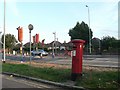
Strouden: postbox № BH8 254, Castle Lane West
This George VI-reign postbox stands on a grass patch between the main carriageway and a small service road of Castle Lane West. Improvement works on this busy road are currently underway, among them installation of a pedestrian crossing, in the distance.
Image: © Chris Downer
Taken: 13 Jul 2008
0.07 miles
4
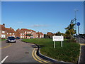
Bournemouth : Bournemouth War Memorial Homes & Castle Lane West
Image: © Lewis Clarke
Taken: 16 Oct 2009
0.07 miles
5
Strouden: footpath K34 from Craigmoor Close
This public footpath heads diagonally from the dead end of Craigmoor Close, heading for the similar dead end in Leydene Close.
Behind the bungalows we see the back of Image, to which an offshoot path also connects from midway along. The church is built on steeply sloping ground and the main access from Mount Pleasant Drive is at a higher level. (See Image for a view from down the road behind us.)
See Image for the view towards us from along the path, and further links to photos towards Leydene Close and the church.
Image: © Chris Downer
Taken: 13 Jul 2016
0.08 miles
6
Strouden: footpath K34 approaches Craigmoor Close
This public footpath leads from Leydene Close to the similar dead end of Craigmoor Close, ahead.
See Image for the view towards us from the turning area, and Image for the next view on the path behind us, with links to further photos on both mentioned routes.
Image: © Chris Downer
Taken: 13 Jul 2016
0.08 miles
7
Strouden: junction of footpaths K34 and K50
This public footpath, numbered K34, runs between the dead ends of Leydene Close (behind us) and Craigmoor Close (ahead, right). Meanwhile, a very short path, K50, heads left to Mount Pleasant Drive via the car park of St. Barnabas' church.
See:
Image for the next view on the path ahead-right;
Image for the view up to the church, ahead-left; and
Image for the view behind us onto Leydene Close.
Image: © Chris Downer
Taken: 13 Jul 2016
0.10 miles
9
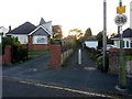
Strouden: footpath K34 from Leydene Close
This public footpath proceeds from the dead end of Leydene Close to the dead end of the similar Craigmoor Close. Behind the bungalow to the left we see the top of Image, to which an offshoot path also connects from midway along.
See Image for the view towards us from along the path, and links to further photos on the routes to Craigmoor Close and the church.
Image: © Chris Downer
Taken: 13 Jul 2016
0.11 miles
10
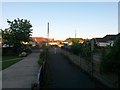
Strouden: footpath K34 reaches Leydene Close
This public footpath from Craigmoor Close arrives at the head of the similar Leydene Close.
See Image for the view towards us from the end of the path, and Image for the next view behind us, with links to further pictures along both mentioned routes.
Image: © Chris Downer
Taken: 13 Jul 2016
0.11 miles