
IMAGES TAKEN NEAR TO
Uplands Road, BOURNEMOUTH, BH8 9SS
Introduction
This page details the photographs taken nearby to Uplands Road, BH8 9SS by members of the Geograph project.
The Geograph project started in 2005 with the aim of publishing, organising and preserving representative images for every square kilometre of Great Britain, Ireland and the Isle of Man.

There are currently over 7.5m images from over14,400 individuals and you can help contribute to the project by visiting https://www.geograph.org.uk
Image Map
Images are licensed for reuse under creativecommons.org/licenses/by-sa/2.0
Notes
- Clicking on the map will re-center to the selected point.
- The higher the marker number, the further away the image location is from the centre of the postcode.
Image Listing (83 Images Found)
Images are licensed for reuse under creativecommons.org/licenses/by-sa/2.0
Image
Details
Distance
1
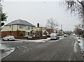
Winter weather in Charminster, Bournemouth
A wintry scene on Uplands Road in Charminster, in the northern suburbs of Bournemouth.
This image was taken during a cold snap in December 2022. A dusting of snow had fallen overnight. It had turned to slush on the road surface as cars had driven over it.
Image: © Malc McDonald
Taken: 11 Dec 2022
0.02 miles
2
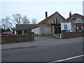
Charminster: Charminster Chapel
A small chapel between nos. 512 and 516 Charminster Road.
Image: © Chris Downer
Taken: 2 Mar 2008
0.09 miles
3
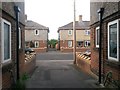
Charminster: footpath M07 reaches Luckham Road East
This public footpath, running through the small Luckham estate, produces a pleasingly symmetrical scene as it comes out on Luckham Road East. A similar footpath - path M08 - comes out directly opposite to continue the journey ahead.
See Image for a similar view towards us from the path ahead, and Image for the next view behind us - each with links to further photos along the route.
Image: © Chris Downer
Taken: 11 Jul 2016
0.10 miles
4
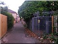
Charminster: substation on footpath M08
Looking south along this public footpath through the small Luckham estate, as it passes an electricity substation.
See Image for the next view along the path ahead, and Image for the next view behind us - each with links to further photos along the route.
Image: © Chris Downer
Taken: 11 Jul 2016
0.10 miles
5
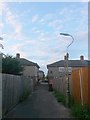
Charminster: lamppost on footpath M08
Looking north along this public footpath through the small Luckham estate, as it passes a lamppost on its way to Charminster Place.
See Image for the next view along the path ahead, and Image for the next view behind us - each with links to further photos along the route.
Image: © Chris Downer
Taken: 11 Jul 2016
0.10 miles
6
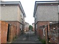
Charminster: footpath M08 reaches Luckham Road East
This public footpath, running through the north end of the Luckham estate, comes out rather symmetrically onto Luckham Road East. A similar footpath - path M07 - comes out directly opposite to continue the journey through the estate.
See Image for a similar view towards us from the path ahead, and Image for the next view along the path behind us - each with links to further photos along the route.
Image: © Chris Downer
Taken: 11 Jul 2016
0.10 miles
7
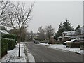
Winter weather in Charminster, Bournemouth
A wintry scene on Uplands Road in Charminster, in the northern suburbs of Bournemouth.
This image was taken during a cold snap in December 2022. A dusting of snow had fallen overnight. It had turned to slush on the road surface as cars had driven over it.
Image: © Malc McDonald
Taken: 11 Dec 2022
0.11 miles
8
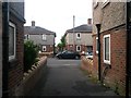
Charminster: footpath M08 reaches Charminster Place
Looking across Charminster Place, near its dead end, from the emergence of this public footpath from the south. Ahead of us, a similar footpath, M16, continues the journey to Luckham Road.
The view is not quite as symmetrical as the similar crossing point on Luckham Road East behind us (Image), because the house on the left is at the turning circle and so set back slightly compared with the right-hand house.
See Image for a view towards us from the path ahead - at a slightly different angle to take in the turning circle of the road - and Image for the next view behind us. Each contains further links to photos along the route.
Image: © Chris Downer
Taken: 11 Jul 2016
0.11 miles
9
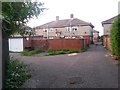
Charminster: garages off footpath M07
This public footpath runs through the small Luckham estate and is seen here approaching its northern end on Luckham Road East. We see the first of a row of garages for which the path acts as a driveway.
See Image for the next view along the path ahead, and Image for the next view behind us.
Image: © Chris Downer
Taken: 11 Jul 2016
0.11 miles
10
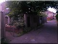
Charminster: access to Luckham Close from footpath M07
Looking along this public footpath through the Luckham estate, towards Charminster Place. To the left is one of two similar pathways, to each corner of the Luckham Close dead end, which are not officially designated as public rights of way.
See Image for the next view along the path ahead, and Image for the next view behind us - each with links to further pictures on the route.
Image: © Chris Downer
Taken: 11 Jul 2016
0.11 miles