
IMAGES TAKEN NEAR TO
Broad Avenue, BOURNEMOUTH, BH8 9HE
Introduction
This page details the photographs taken nearby to Broad Avenue, BH8 9HE by members of the Geograph project.
The Geograph project started in 2005 with the aim of publishing, organising and preserving representative images for every square kilometre of Great Britain, Ireland and the Isle of Man.

There are currently over 7.5m images from over14,400 individuals and you can help contribute to the project by visiting https://www.geograph.org.uk
Image Map
Images are licensed for reuse under creativecommons.org/licenses/by-sa/2.0
Notes
- Clicking on the map will re-center to the selected point.
- The higher the marker number, the further away the image location is from the centre of the postcode.
Image Listing (41 Images Found)
Images are licensed for reuse under creativecommons.org/licenses/by-sa/2.0
Image
Details
Distance
1
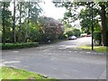
Hadden Avenue, Bournemouth
The junction of Hadden Avenue with Broad Avenue
Image: © Nigel Mykura
Taken: 13 Sep 2008
0.05 miles
2
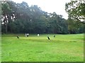
Golf Course, Queens Park, Bournemouth
A view of one of the greens adjacent to and on the south side of Queens Park Avenue.
Image: © Nigel Mykura
Taken: 13 Sep 2008
0.10 miles
3
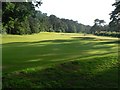
Queen?s Park: the third
To the right, over the hedge, is Queen’s Park Avenue.
Image: © Chris Downer
Taken: 22 Jun 2008
0.12 miles
4
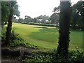
Queen?s Park: looking across the third fairway
The upmarket houses on Queen’s Park Avenue can be seen across the fairway.
Image: © Chris Downer
Taken: 22 Jun 2008
0.12 miles
5
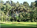
Queen?s Park: third green
The trees and lawn catch the evening sun here on the third green at Queen’s Park.
Image: © Chris Downer
Taken: 22 Jun 2008
0.12 miles
6
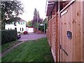
Queen?s Park: a house?s side entrance onto footpath K04
This short public footpath - 27m in length - leads from between 17 and 19 Bower Road into the wooded edge of Strouden public open space. We see it here arriving onto Bower Road, with a side gate from no.17 opening onto the path.
See Image for the view along the path from across the road, and Image for the view behind us into the wood.
Image: © Chris Downer
Taken: 5 Oct 2016
0.12 miles
7
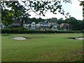
Queen?s Park: golf course and Queen?s Park Avenue
Looking across the golf course at some of Bournemouth's most upmarket houses, in Queen’s Park Avenue, whose odds outnumber evens owing to the golf course abutting it for much of its length.
Image: © Chris Downer
Taken: 22 Jun 2008
0.13 miles
8
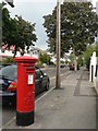
Queen?s Park: postbox № BH8 265, Brackendale Road
A George V-reign box in Brackendale Road, opposite Bower Road.
Image: © Chris Downer
Taken: 1 Jul 2008
0.13 miles
9
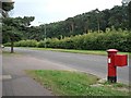
Queen?s Park: postbox № BH8 20, Queen?s Park Avenue
This postbox is on Queen's Park Avenue, outside number 119, far enough east that housing on the southern side of the Avenue has given way to the golf course.
Image: © Chris Downer
Taken: 1 Jul 2008
0.13 miles
10
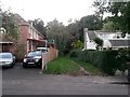
Queen?s Park: footpath K04 from Bower Road
This short public footpath - 27m in length - leads from between 17 and 19 Bower Road into the wooded edge of Strouden public open space.
See Image for the view onto the road from along the path, with links to a couple of other photos on the route.
Image: © Chris Downer
Taken: 5 Oct 2016
0.14 miles