
IMAGES TAKEN NEAR TO
Orcheston Road, BOURNEMOUTH, BH8 8SR
Introduction
This page details the photographs taken nearby to Orcheston Road, BH8 8SR by members of the Geograph project.
The Geograph project started in 2005 with the aim of publishing, organising and preserving representative images for every square kilometre of Great Britain, Ireland and the Isle of Man.

There are currently over 7.5m images from over14,400 individuals and you can help contribute to the project by visiting https://www.geograph.org.uk
Image Map
Images are licensed for reuse under creativecommons.org/licenses/by-sa/2.0
Notes
- Clicking on the map will re-center to the selected point.
- The higher the marker number, the further away the image location is from the centre of the postcode.
Image Listing (35 Images Found)
Images are licensed for reuse under creativecommons.org/licenses/by-sa/2.0
Image
Details
Distance
1
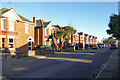
Houses on Orcheston Road, Bournemouth
Detached houses but rather close together, typical of the streets in this area.
Image: © Robin Webster
Taken: 25 Nov 2016
0.02 miles
2
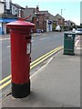
Malmesbury Park: postbox № BH8 95, Bennett Road
This postbox stands outside the former Bennett Road Post Office, which closed down on 9 February 2004. After the closure of the branch there remained a Post Office-branded cashpoint, but the entire building was demolished in mid-2008 to be replaced by dwellings.
Image: © Chris Downer
Taken: 19 Jul 2008
0.07 miles
3
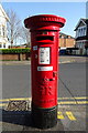
George V postbox on Bennett Road
Postbox No. BH8 95.
Image: © JThomas
Taken: 23 Mar 2022
0.09 miles
4

Malmesbury Park: Capstone Road
Malmesbury Park, named after a one-time landowner in the area – the Earl of Malmesbury, consists of a number of long straight roads like this one, with similar detached houses on either side. St. Leonard's Road crosses them all, and this is the crossroads.
Image: © Chris Downer
Taken: 1 Jan 2008
0.09 miles
5
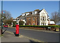
Flats on Bennett Road
Showing position of Postbox No. BH8 95.
Image: © JThomas
Taken: 23 Mar 2022
0.10 miles
6
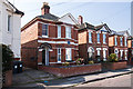
Bournemouth - 175, Capstone Road
The former home of Corporal Cecil Reginald Noble VC (1891 - 1915) one of two posthumously awarded recipients of the Victoria Cross during WWI who lived in the same street. He was fatally wounded at Neuve Chapelle in 1915.
Image
Image: © Mike Searle
Taken: 9 Apr 2015
0.10 miles
7
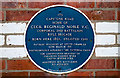
Bournemouth Blue Plaques: No. 19 - C R Noble VC 175, Capstone Road
One of two posthumously awarded recipients of the Victoria Cross who lived in this one suburban street in Bournemouth, something of a record maybe. This plaque commemorates the posthumous award of the VC to Corporal Cecil Reginald Noble who was fatally wounded at Neuve Chapelle in 1915, and who was born here in 1891 at 175, Capstone Road.
Image
Image
Image: © Mike Searle
Taken: 9 Apr 2015
0.10 miles
8
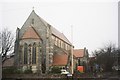
Malmesbury Park: parish church of St. Andrew
Image: © Chris Downer
Taken: Unknown
0.10 miles
9
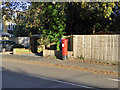
Postbox BH8 72D
A Victorian model on Howard Road.
Image: © Robin Webster
Taken: 25 Nov 2016
0.11 miles
10
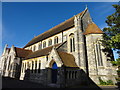
St Andrews Church
The South Cross is an Ordnance Survey Triangulation point, http://www.trigpointinguk.com/trigs/trig-details.php?t=9332
Image: © Mat Tuck
Taken: 26 Jul 2013
0.12 miles