
IMAGES TAKEN NEAR TO
Jewell Road, BOURNEMOUTH, BH8 0JP
Introduction
This page details the photographs taken nearby to Jewell Road, BH8 0JP by members of the Geograph project.
The Geograph project started in 2005 with the aim of publishing, organising and preserving representative images for every square kilometre of Great Britain, Ireland and the Isle of Man.

There are currently over 7.5m images from over14,400 individuals and you can help contribute to the project by visiting https://www.geograph.org.uk
Image Map
Images are licensed for reuse under creativecommons.org/licenses/by-sa/2.0
Notes
- Clicking on the map will re-center to the selected point.
- The higher the marker number, the further away the image location is from the centre of the postcode.
Image Listing (32 Images Found)
Images are licensed for reuse under creativecommons.org/licenses/by-sa/2.0
Image
Details
Distance
1
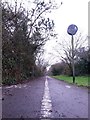
Townsend: dividing line on footpath K45
This public footpath, nowadays marked out as a shared foot/cycle route, runs for 500m or so alongside the main A338 and is essentially a replacement for this segment of Holdenhurst Road, which was lost to make way for the dual carriageway. Holdenhurst Road is still one of the town's main routes but no longer reaches Holdenhurst village as it originally did.
Here, the camera is positioned low to the ground as we look along the white line separating the intended cycle and walking halves of the paved path.
See Image for the next view on the path ahead, and Image for the next view behind us - each with links to further photos along the route.
Image: © Chris Downer
Taken: 8 Jan 2017
0.12 miles
2
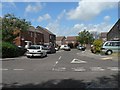
Townsend: Tyrrell Gardens
Townsend is a substantial 70s council estate in north Bournemouth. This, Tyrrell Gardens, is typical of the side streets off Jewell Road, the horseshoe-shaped main road through the estate.
Image: © Chris Downer
Taken: 22 Jun 2008
0.13 miles
3
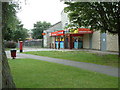
One-Stop shop, North Bournemouth
This shop/post office is found between Strouden and Holdenhurst.
Image: © Stuart Buchan
Taken: 1 Aug 2005
0.13 miles
4
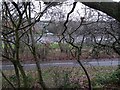
Townsend: view across footpath K45 and the Spur Road
This public footpath, nowadays marked out as a shared foot/cycle route, runs for 500m or so alongside the main A338 and is essentially a replacement for this segment of Holdenhurst Road, which was lost to make way for the dual carriageway. Holdenhurst Road is still one of the town's main routes but no longer reaches Holdenhurst village as it originally did.
Here, we look across the path from a steep bank separating it from a public green space. The view extends across the A338 Spur Road at the point where a slip road joins the main carriageway (see the thick white markings at the extreme right-hand edge of the picture).
See Image for the next view on the path to the left, and Image for the next view to the right - each with links to further photos along the route.
Image: © Chris Downer
Taken: 8 Jan 2017
0.14 miles
5
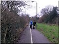
Townsend: dog walkers meet on footpath K45
This public footpath, nowadays marked out as a shared foot/cycle route, runs for 500m or so alongside the main A338 and is essentially a replacement for this segment of Holdenhurst Road, which was lost to make way for the dual carriageway. Holdenhurst Road is still one of the town's main routes but no longer reaches Holdenhurst village as it originally did.
Here, we look along the path just as two dog walkers, with five dogs between them, stop to chat about a quarter of the way along the path.
See Image for the next view on the path ahead, and Image for the next view behind us - each with links to further photos along the route.
Image: © Chris Downer
Taken: 8 Jan 2017
0.14 miles
6

Townsend: primary school and community centre
Controversially, Bournemouth Borough Council voted, on 3 June 2008, to close Townsend Primary & Nursery School at the end of this term. The decision followed years of underachievement, inadequacy cited in Ofsted reports, and falling rolls. However, the week before the school had come out of "Special Measures" by Ofsted, suggesting that improvement had started to surface.
As well as the educational implications, people on the estate are worried about whether the site, once the school has closed, will retain a community function or if it will be sold off.
Image: © Chris Downer
Taken: 8 Jun 2008
0.14 miles
8
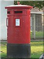
Townsend: postbox № BH8 178, Jewell Road
Detail of the postbox outside Image, which replaced an earlier, single-aperture box which has a letter-bomb posted into it during one of the more troubled episodes of the Townsend estate. Townsend has always had a bad reputation but I don't believe it's as bad as all that – it's never going to be the most sought-after place but, I expect, if you wanted a proper sense of 'community', few suburbs of Bournemouth would match it.
Image: © Chris Downer
Taken: 22 Jul 2008
0.15 miles
9
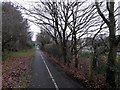
Townsend: footpath K45 alongside the Spur Road
This public footpath, nowadays marked out as a shared foot/cycle route, runs for 500m or so alongside the main A338 and is essentially a replacement for this segment of Holdenhurst Road, which was lost to make way for the dual carriageway. Holdenhurst Road is still one of the town's main routes but no longer reaches Holdenhurst village as it originally did.
Here, we look eastward along the path and can see the main A338, known as the Spur Road, through the trees to the right. We are just alongside the point where the northbound on-slip starts to join the main carriageway.
See Image for the next view on the path ahead, and Image for the next view behind us - each with links to further photos along the route.
Image: © Chris Downer
Taken: 8 Jan 2017
0.15 miles
10
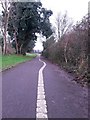
Townsend: the line along footpath K45 is skew-whiff
This public footpath, nowadays marked out as a shared foot/cycle route, runs for 500m or so alongside the main A338 and is essentially a replacement for this segment of Holdenhurst Road, which was lost to make way for the dual carriageway. Holdenhurst Road is still one of the town's main routes but no longer reaches Holdenhurst village as it originally did.
Here, we look along the path about three quarters of the way to the eastern end, as the dividing line between the foot and cycle paths takes an unexpected diversion for a few yards.
See Image for the next view on the path ahead, and Image for the next view behind us - each with links to further photos along the route.
Image: © Chris Downer
Taken: 8 Jan 2017
0.16 miles