
IMAGES TAKEN NEAR TO
Castle Lane East, BOURNEMOUTH, BH7 7DW
Introduction
This page details the photographs taken nearby to Castle Lane East, BH7 7DW by members of the Geograph project.
The Geograph project started in 2005 with the aim of publishing, organising and preserving representative images for every square kilometre of Great Britain, Ireland and the Isle of Man.

There are currently over 7.5m images from over14,400 individuals and you can help contribute to the project by visiting https://www.geograph.org.uk
Image Map
Images are licensed for reuse under creativecommons.org/licenses/by-sa/2.0
Notes
- Clicking on the map will re-center to the selected point.
- The higher the marker number, the further away the image location is from the centre of the postcode.
Image Listing (49 Images Found)
Images are licensed for reuse under creativecommons.org/licenses/by-sa/2.0
Image
Details
Distance
1
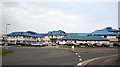
Royal Bournemouth Hospital
This is a large modern district general hospital with a distinctive blue roof on an out of town site. It covers a larger area than the photo shows. It replaced the Royal Victoria Hospital, Boscombe, (where my father worked up to 1968) which was demolished and turned into a supermarket.
Looking across a roundabout on Deansleigh Road. This is not the main entrance to the hospital for patients.
See http://tinyurl.com/2apvq6o for pictures of the Royal Victoria Hospital being demolished in 1993.
See http://www.rbch.nhs.uk/ for Royal Bournemouth Hospital NHS website.
Image: © Peter Facey
Taken: 11 Oct 2005
0.04 miles
2
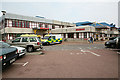
Accident & emergency entrance to Royal Bournemouth Hospital
The ambulance entry is at left while that for the walking wounded is to the right of the pedestrian.
Image: © Peter Facey
Taken: 11 Oct 2005
0.05 miles
3
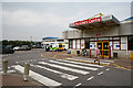
Accident & Emergency entrance to Royal Bournemouth Hospital
This is the pedestrian entrance to the A & E department. It may be obvious but the entrance for ambulances is just round the corner of the building where you can see the ambulances.
Image: © Peter Facey
Taken: 11 Oct 2005
0.06 miles
4
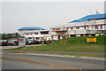
Accident & Emergency entrance to Royal Bournemouth Hospital
With helicopter landing pad at right.
Image: © Peter Facey
Taken: 11 Oct 2005
0.06 miles
5
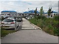
Littledown: Royal Bournemouth General Hospital
A view of the distinctive hospital building, with its blue roofs, off Castle Lane East in the north of the borough. The picture is taken from the path leading from the main access corner. Just to our right, improved bus stops have been recently constructed, truncating the car park somewhat, to the right of the zebra crossing markings (see Image).
Image: © Chris Downer
Taken: 21 Jun 2016
0.08 miles
6
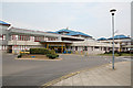
Main entrance to Royal Bournemouth Hospital
As approached from its car park.
Image: © Peter Facey
Taken: 11 Oct 2005
0.09 miles
7
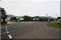
Main entrance to Royal Bournemouth Hospital
From roundabout in Deansleigh Road.
Image: © Peter Facey
Taken: 11 Oct 2005
0.10 miles
8
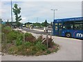
Littledown: new bus stops at the hospital
An improvement on the congested single lane of bus stops previously here, this mini bus station has eaten into the car park of the Image
Because buses stop here in both directions of the bus route, u-turning at the roundabout just ahead, it is now more difficult to get on a bus with the correct number but heading in the wrong direction.
Image: © Chris Downer
Taken: 21 Jun 2016
0.13 miles
9
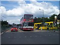
Bournemouth : Deansleigh Road
Deansleigh Road road junction - waiting at traffic lights
Image: © Lewis Clarke
Taken: 6 Jun 2008
0.13 miles
10
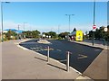
Littledown: new bus stops at the hospital
The bus stop area outside the Royal Bournemouth Hospital were improved vastly a couple of years ago - prior to this, there was just a narrow pull-in in addition to the roadside stops.
As the buses here call into the side road and retrace onto Castle Lane, buses in all directions face the same way rather than being on opposite sides of the road. Therefore, there is now increased capacity to separate buses with the same number but going in opposite directions.
Image: © Chris Downer
Taken: 17 Oct 2016
0.13 miles