
IMAGES TAKEN NEAR TO
Holmfield Avenue, BOURNEMOUTH, BH7 6SF
Introduction
This page details the photographs taken nearby to Holmfield Avenue, BH7 6SF by members of the Geograph project.
The Geograph project started in 2005 with the aim of publishing, organising and preserving representative images for every square kilometre of Great Britain, Ireland and the Isle of Man.

There are currently over 7.5m images from over14,400 individuals and you can help contribute to the project by visiting https://www.geograph.org.uk
Image Map
Images are licensed for reuse under creativecommons.org/licenses/by-sa/2.0
Notes
- Clicking on the map will re-center to the selected point.
- The higher the marker number, the further away the image location is from the centre of the postcode.
Image Listing (55 Images Found)
Images are licensed for reuse under creativecommons.org/licenses/by-sa/2.0
Image
Details
Distance
1
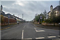
Bournemouth : Holmfield Avenue
Holmfield Avenue off of Castle Lane East.
Image: © Lewis Clarke
Taken: 27 Mar 2018
0.04 miles
2
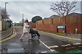
Bournemouth : Iford Gardens
Looking along Iford Gardens from Castle Lane East.
Image: © Lewis Clarke
Taken: 27 Mar 2018
0.08 miles
3
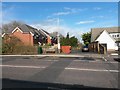
Iford: Sheepwash Lane from Castle Lane East
Looking across the busy main A3060, Castle Lane East, along this short lane which is a public footpath, number J11 - it is a short one, extending from the road just to the gate in the background, although onward public access is available to the riverside path from there.
I think it is only in the last 10 years or so - since the row of houses was built - that the little lane has been tarmacked.
See Image for the next view on the footpath.
Image: © Chris Downer
Taken: 5 Mar 2017
0.09 miles
4
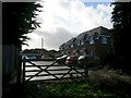
Iford: through the gate onto Sheepwash Lane
Looking along this public footpath, number J11, from the gateway giving access to the riverside path behind us. It is a short public footpath, just leading here from the main Castle Lane which is visible in the background (the left-facing white car is travelling along it).
I think it is only in the last 10 years or so - since the row of houses was built - that the little lane has been tarmacked. Although the area here was certainly historically known as Sheepwash, it may only be as a result of the houses needing a postal address that the lane has officially been called Sheepwash Lane.
See Image for the view from the far end, and Image for a view through the gate towards us.
Image: © Chris Downer
Taken: 5 Mar 2017
0.10 miles
5
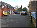
Iford: the sign for Sheepwash Lane
Looking along this public footpath, number J11, from its name sign - it is a short one, extending from the road here just to the gate in the background, although onward public access is available to the riverside path from there.
I think it is only in the last 10 years or so - since the row of houses was built - that the little lane has been tarmacked. Although the area here was certainly historically known as Sheepwash, it may only be as a result of the houses needing a postal address that the lane has officially been called Sheepwash Lane.
See Image for the view from across Castle Lane behind us, and Image for a view along the path from the far gate.
Image: © Chris Downer
Taken: 5 Mar 2017
0.10 miles
6
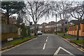
Bournemouth : Cheriton Avenue
Looking along Cheriton Avenue from Castle Lane East.
Image: © Lewis Clarke
Taken: 27 Mar 2018
0.11 miles
7
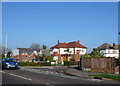
Bridle Crescent
These large modern detached houses are just off Castle Lane East, the A3060 close to its junction with the A35. They have been built as infill on the spare land round the roundabout at the junction.
Image: © Nigel Mykura
Taken: 15 Nov 2011
0.11 miles
8
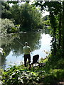
Iford: angling on the Stour
A man enjoys a warm, sunny morning on the bank of the river.
Image: © Chris Downer
Taken: 3 Jul 2011
0.11 miles
10
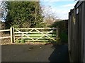
Iford: gate at the end of Sheepwash Lane
Sheepwash Lane is a short public footpath, number J11, from Castle Lane behind us to this gate, giving access to the riverside path (the onward path swings left just beyond the gate).
The area here was certainly historically known as Sheepwash, and that word is carved into the topmost bar of the gate - it may only be as a result of the houses, built ten years or so ago on the lane, needing a postal address that the lane itself has officially been called Sheepwash Lane.
See Image for the view through the gate along the lane behind us.
Image: © Chris Downer
Taken: 5 Mar 2017
0.11 miles