
IMAGES TAKEN NEAR TO
Holdenhurst Avenue, BOURNEMOUTH, BH7 6RG
Introduction
This page details the photographs taken nearby to Holdenhurst Avenue, BH7 6RG by members of the Geograph project.
The Geograph project started in 2005 with the aim of publishing, organising and preserving representative images for every square kilometre of Great Britain, Ireland and the Isle of Man.

There are currently over 7.5m images from over14,400 individuals and you can help contribute to the project by visiting https://www.geograph.org.uk
Image Map
Images are licensed for reuse under creativecommons.org/licenses/by-sa/2.0
Notes
- Clicking on the map will re-center to the selected point.
- The higher the marker number, the further away the image location is from the centre of the postcode.
Image Listing (40 Images Found)
Images are licensed for reuse under creativecommons.org/licenses/by-sa/2.0
Image
Details
Distance
1
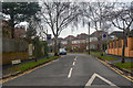
Bournemouth : Cheriton Avenue
Looking along Cheriton Avenue from Castle Lane East.
Image: © Lewis Clarke
Taken: 27 Mar 2018
0.08 miles
2
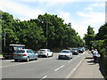
Castle Lane East, Bournemouth
Castle Lane East is a busy road through Bournemouth's north-eastern suburbs. It forms part of the route of the A3060.
Image: © Malc McDonald
Taken: 21 Jun 2022
0.08 miles
3
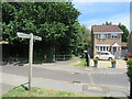
Footpath and cycle route near Littledown, Bournemouth
A shared path for pedestrians and cyclists through Bournemouth's north-eastern suburbs.
Image: © Malc McDonald
Taken: 21 Jun 2022
0.09 miles
4
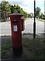
Iford: postbox № BH7 329, Holdenhurst Avenue
Behind the postbox, we look along Ovington Avenue.
Image: © Chris Downer
Taken: 19 Jul 2008
0.10 miles
5
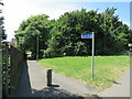
Footpath and cycle route near Littledown, Bournemouth
A footpath which is also open to cyclists in the north-eastern suburbs of Bournemouth.
Image: © Malc McDonald
Taken: 21 Jun 2022
0.10 miles
6
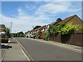
Bartlett Drive, Littledown
Bartlett Drive forms part of a modern housing development in Littledown, in Bournemouth's north-eastern suburbs.
Image: © Malc McDonald
Taken: 21 Jun 2022
0.11 miles
7
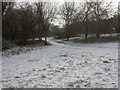
Iford, Sheepwash
The area North of Iford on the Western bank of the Stour is known as Sheepwash; this doesn't seem logical, as farming locally was traditionally dairy. Forecasts of extreme weather haven't (yet) materialised; just a pleasant smattering of snow on the ground.
Image: © Mike Faherty
Taken: 2 Feb 2009
0.14 miles
8
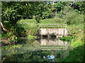
Iford: issues of the Stour
I'm not exactly sure where the water comes from but it emerges here into the more minor of the two courses of the Stour just before the two streams unite.
Image: © Chris Downer
Taken: 3 Jul 2011
0.14 miles
9
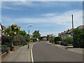
Petersfield Road, Bournemouth
Petersfield Road is a residential road in the north-eastern suburbs of Bournemouth.
Image: © Malc McDonald
Taken: 21 Jun 2022
0.15 miles
10

Bournemouth : Riverside Avenue
The traffic light is about to go green
Image: © Lewis Clarke
Taken: 6 Jun 2008
0.15 miles