
IMAGES TAKEN NEAR TO
York Place, BOURNEMOUTH, BH7 6JN
Introduction
This page details the photographs taken nearby to York Place, BH7 6JN by members of the Geograph project.
The Geograph project started in 2005 with the aim of publishing, organising and preserving representative images for every square kilometre of Great Britain, Ireland and the Isle of Man.

There are currently over 7.5m images from over14,400 individuals and you can help contribute to the project by visiting https://www.geograph.org.uk
Image Map
Images are licensed for reuse under creativecommons.org/licenses/by-sa/2.0
Notes
- Clicking on the map will re-center to the selected point.
- The higher the marker number, the further away the image location is from the centre of the postcode.
Image Listing (149 Images Found)
Images are licensed for reuse under creativecommons.org/licenses/by-sa/2.0
Image
Details
Distance
1
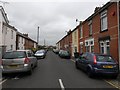
Boscombe: York Place
A typical street for this immediate part of Boscombe - Victorian terraces with very limited parking on its narrow carriageway. York Place meets a dead end ahead, at the railway embankment, but a path continues towards Christchurch Road - see Image for the next view on the path ahead, each with links to further photos along the routes.
Image: © Chris Downer
Taken: 25 Feb 2017
0.01 miles
2
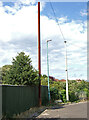
York Place Boscombe (2)
A Victorian era stench pipe is still in-situ at the end of the street. Also known as a stink pipe, they are found above ground in order to vent off noxious and inflammable gases from the sewers below, releasing them high above street level. A series of two or three can occasionally be found in urban areas in a line that follow the route of the old sewer network. With urban regeneration, they are becoming increasingly uncommon, and even rare, some with Grade II listing.
A number of different manufacturers made them, the names of which can often be found at the base of the pipe. It is believed that this particular example has the almost illegible name of 'J Stone & Co., Deptford, London' in embossed letters on the base. The pipes would eventually became obsolete due to advances in domestic and public sewage processing in the 20th century, so very few remain.
Image
Image: © Mike Searle
Taken: 20 Jul 2023
0.01 miles
3
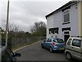
Boscombe: the end of York Place
Hannington Place is a public footpath, number G04, and also a driveway to a few properties, which runs from Christchurch Road, turns to run alongside the railway line and comes out at the dead end of York Place. The longer straight, abutting the railway, has been tarmacked in fairly recent years, having been a gravel drive previously.
Here, we look at the start of the path at the dead end of Image - York Place actually continues along the path a little, whereupon it becomes Hannington Place.
See Image for the next view on the path ahead, each with links to further photos along the routes.
Image: © Chris Downer
Taken: 25 Feb 2017
0.02 miles
4
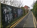
Pokesdown: Hannington Place heads for York Place
Hannington Place is a public footpath, number G04, and also a driveway to a few properties, which runs from Christchurch Road, turns to run alongside the railway line and comes out at the dead end of York Place. The longer straight, abutting the railway, has been tarmacked in fairly recent years, having been a gravel drive previously.
Here, we look along it as it runs alongside the railway; the house ahead is the last property in York Place.
See Image for the next view on the path ahead, and Image for the next view behind us - each with links to further photos along the routes.
Image: © Chris Downer
Taken: 25 Feb 2017
0.03 miles
5
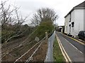
Boscombe: footpath G04 from York Place
Hannington Place is a public footpath, number G04, and also a driveway to a few properties, which runs from Christchurch Road, turns to run alongside the railway line and comes out at the dead end of York Place. The longer straight, abutting the railway, has been tarmacked in fairly recent years, having been a gravel drive previously.
Here, we look along it from the dead end of York Place - York Place actually continues along here to the end of the last house, whereupon it becomes Hannington Place.
See Image for the view from behind us at the dead end, and Image for the next view on the path ahead, each with links to further photos along the routes.
Image: © Chris Downer
Taken: 25 Feb 2017
0.03 miles
6
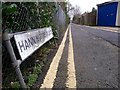
Pokesdown: York Place becomes Hannington Place
Hannington Place is a public footpath, number G04, and also a driveway to a few properties, which runs from Christchurch Road, turns to run alongside the railway line and comes out at the dead end of York Place. The longer straight, abutting the railway, has been tarmacked in fairly recent years, having been a gravel drive previously.
Here, we look along it as York Place (which includes the first part of the path) becomes Hannington Place, as signified by the sign.
See Image for the next view on the path ahead, and Image for the next view behind us - each with links to further photos along the routes.
Image: © Chris Downer
Taken: 25 Feb 2017
0.04 miles
7
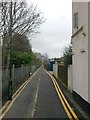
Boscombe: the last house in York Place
Hannington Place is a public footpath, number G04, and also a driveway to a few properties, which runs from Christchurch Road, turns to run alongside the railway line and comes out at the dead end of York Place. The longer straight, abutting the railway, has been tarmacked in fairly recent years, having been a gravel drive previously.
Here, we look along it from the York Place end - the path has already begun from the dead end of the 'regular' carriageway, but the house numbering continues to number 52 which is just on our right. The path then becomes Hannington Place, signified by the little sign on the left.
See Image for the next view on the path ahead, and Image for the next view behind us - each with links to further photos along the routes.
Image: © Chris Downer
Taken: 25 Feb 2017
0.04 miles
8
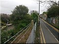
Pokesdown: Hannington Place and the end of the station platforms
Hannington Place is a public footpath, number G04, and also a driveway to a few properties, which runs from Christchurch Road, turns to run alongside the railway line and comes out at the dead end of York Place. The longer straight, abutting the railway, has been tarmacked in fairly recent years, having been a gravel drive previously.
Here, we look along it as it runs alongside the railway - Pokesdown station has particularly long platforms and by the time we reach this western extremity, the canopy has long come to an end.
See Image for the next view on the path ahead, and Image for the next view behind us - each with links to further photos along the routes.
Image: © Chris Downer
Taken: 25 Feb 2017
0.05 miles
9
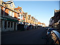
Boscombe East: the post office
There was a post office here until the 1970s. It reopened on 7 May 1997, shortly after the nearest alternative closed down.
Image: © Chris Downer
Taken: 26 Dec 2008
0.08 miles
10
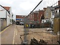
Boscombe East: eastbound on Warwick Place
Warwick Place is a rear access driveway for even numbered shops 834-892 Christchurch Road (to our right) and the flats above. It also forms a public right of way, footpath G06 between Warwick and Hannington Roads.
This view is from only a short distance into the lane here, from the Warwick Road end. There is a cordon on the right as some work is being done on this particular yard.
See Image for the next view on the path ahead, and Image for the next view behind - each with links to further photos along the route.
Image: © Chris Downer
Taken: 25 Feb 2017
0.08 miles