
IMAGES TAKEN NEAR TO
Christchurch Road, BOURNEMOUTH, BH7 6DW
Introduction
This page details the photographs taken nearby to Christchurch Road, BH7 6DW by members of the Geograph project.
The Geograph project started in 2005 with the aim of publishing, organising and preserving representative images for every square kilometre of Great Britain, Ireland and the Isle of Man.

There are currently over 7.5m images from over14,400 individuals and you can help contribute to the project by visiting https://www.geograph.org.uk
Image Map
Images are licensed for reuse under creativecommons.org/licenses/by-sa/2.0
Notes
- Clicking on the map will re-center to the selected point.
- The higher the marker number, the further away the image location is from the centre of the postcode.
Image Listing (159 Images Found)
Images are licensed for reuse under creativecommons.org/licenses/by-sa/2.0
Image
Details
Distance
1
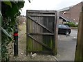
Pokesdown: a gate partially obstructs footpath J12
This public footpath heads to Spurgeon Road from Clarence Park Road, and widens slightly just beyond this gate, which is hindering progress somewhat and appears to be wedged open with a lump of stone.
See Image for the next view on the path ahead, and Image for the next photo behind us - each with links to further photos along the path.
Image: © Chris Downer
Taken: 25 Feb 2017
0.01 miles
2
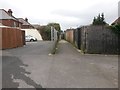
Pokesdown: footpath J12 goes between two fences
This public footpath heads for Spurgeon Road from Clarence Park Road, and has come across a driveway to this point. One of the drives continues to the left but the path heads through the gap directly ahead. It appears to be blocked ahead but in fact that is just a gate that is open.
See Image for the view behind us towards Clarence Park Road, and Image for the next photo on the path ahead - each with links to further photos along the path.
Image: © Chris Downer
Taken: 25 Feb 2017
0.02 miles
3
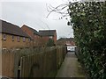
Pokesdown: footpath J12 heads for Clarence Park Road
This public footpath heads from Spurgeon Road to Clarence Park Road, and here is about two thirds of the way there. Immediately below the camera is a gate which is slightly hindering progress on the path.
See Image for the next view on the path ahead, and Image for the next photo behind us - each with links to further photos along the path.
Image: © Chris Downer
Taken: 25 Feb 2017
0.02 miles
4
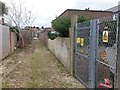
Pokesdown: substation on footpath J12
This public footpath heads to Spurgeon Road from Clarence Park Road, and about halfway along is this electricity substation.
See Image for the next view on the path ahead, and Image for the next photo behind us - each with links to further photos along the path.
Image: © Chris Downer
Taken: 25 Feb 2017
0.02 miles
5
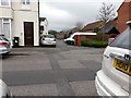
Pokesdown: footpath J12 from Clarence Park Road
Looking across Clarence Park Road from between two parked cars - parking can be difficult in these Victorian terraced streets without off-road provision - along a public footpath which, at this end, has been opened out somewhat to provide a frontage for recently converted flats.
The course of the public footpath continues in the background, between the two visible fences.
See Image for the view towards us from those fences, with links to further photos along the path.
Image: © Chris Downer
Taken: 25 Feb 2017
0.03 miles
6
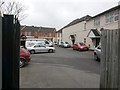
Pokesdown: footpath J12 opens out
This public footpath has come from Spurgeon Road through an alley, and here opens out onto the frontage for recently converted flats. The destination of the path is Clarence Park Road, which we see in the background.
See Image for the view towards us from across the road ahead, and Image for the view behind us along the alley, with links to further photos along the path.
Image: © Chris Downer
Taken: 25 Feb 2017
0.03 miles
7
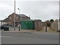
Pokesdown: a Tesco Express and footpath J12
Looking across Spurgeon Road towards a Tesco Express which has been open a few years and is on the site of ... well, I can't remember exactly what (I seem to remember a long-disused filling station, maybe). Behind it runs a public footpath to Clarence Park Road.
See Image for the next photo on the footpath, with links to further photos along the route.
Image: © Chris Downer
Taken: 25 Feb 2017
0.03 miles
8
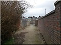
Pokesdown: footpath J12 nears Spurgeon Road
This public footpath heads to Spurgeon Road from Clarence Park Road, and this is the view along the final third of the path.
See Image for the next view on the path ahead, and Image for the next photo behind us - each with links to further photos along the path.
Image: © Chris Downer
Taken: 25 Feb 2017
0.03 miles
9
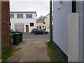
Pokesdown: footpath J07 reaches Scotter Road
This public footpath is one of four rear accesses to premises in Clarence Park Road - two on this odds side and two on the evens side.
See Image for the view towards us from across the road ahead, and Image for the next photo on the path behind us, with links to further photos along the route.
Image: © Chris Downer
Taken: 25 Feb 2017
0.04 miles
10
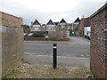
Pokesdown: footpath J12 comes out opposite St. James? School
This public footpath has come from Clarence Park Road and is just reaching its destination, Spurgeon Road. Ahead of us is the rear of St. James' CE Primary School and its staff car park.
See Image for the view towards us from across the road, and Image for the next photo behind us, with links to further photos along the path.
Image: © Chris Downer
Taken: 25 Feb 2017
0.04 miles