
IMAGES TAKEN NEAR TO
Christchurch Road, BOURNEMOUTH, BH7 6DL
Introduction
This page details the photographs taken nearby to Christchurch Road, BH7 6DL by members of the Geograph project.
The Geograph project started in 2005 with the aim of publishing, organising and preserving representative images for every square kilometre of Great Britain, Ireland and the Isle of Man.

There are currently over 7.5m images from over14,400 individuals and you can help contribute to the project by visiting https://www.geograph.org.uk
Image Map
Images are licensed for reuse under creativecommons.org/licenses/by-sa/2.0
Notes
- Clicking on the map will re-center to the selected point.
- The higher the marker number, the further away the image location is from the centre of the postcode.
Image Listing (155 Images Found)
Images are licensed for reuse under creativecommons.org/licenses/by-sa/2.0
Image
Details
Distance
1
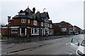
The Bell
Large pub beside the A35 Christchurch Road.
Image: © David Lally
Taken: 12 Mar 2017
0.02 miles
2
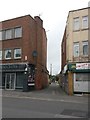
Pokesdown: Hannington Place from Christchurch Road
Hannington Place is a public footpath, number G04, and also a driveway to a few properties, which runs from Christchurch Road, turns to run alongside the railway line and comes out at the dead end of York Place. The longer straight, abutting the railway, has been tarmacked in fairly recent years, having been a gravel drive previously.
We see it here at its beginning, on Christchurch Road, heading between numbers 906 and 908.
See Image for the next view along the path, with links to further photos along the route.
Image: © Chris Downer
Taken: 25 Feb 2017
0.02 miles

4
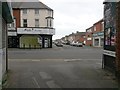
Pokesdown: Hannington Place arrives on Christchurch Road
Hannington Place is a public footpath, number G04, and also a driveway to a few properties, which runs from Christchurch Road, turns to run alongside the railway line and comes out at the dead end of York Place. The longer straight, abutting the railway, has been tarmacked in fairly recent years, having been a gravel drive previously.
We see it here as it emerges onto Christchurch Road, between numbers 906 and 908. Morley Road is opposite.
See Image for the view towards us from across the road, and Image for the next view on the path behind, with links to further photos along the route.
Image: © Chris Downer
Taken: 25 Feb 2017
0.03 miles
5
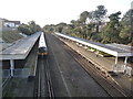
Pokesdown: Bournemouth-bound train at the station
Looking along the very long platforms at Pokesdown station from the footbridge.
Image: © Chris Downer
Taken: 22 Feb 2014
0.03 miles
6
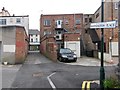
Pokesdown: Hannington Place passes footpath G05
Hannington Place is a public footpath, number G04, and also a driveway to a few properties, which runs from Christchurch Road, turns to run alongside the railway line and comes out at the dead end of York Place. The longer straight, abutting the railway, has been tarmacked in fairly recent years, having been a gravel drive previously.
We see it here as it heads for Christchurch Road (background); crossing just here is a rear access driveway, which is footpath G05 to the right and just a short dead end, Hannington Grove, to the left.
See:
Image for the view towards us from the path ahead;
Image for the next view behind us; and
Image for a view along footpath G05, right.
Each has links to further photos along the routes.
Image: © Chris Downer
Taken: 25 Feb 2017
0.03 miles
7
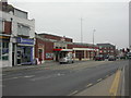
Pokesdown Station
Station originally opened 1886, on the Christchurch-Bournemouth line. Originally called Boscombe, renamed Pokesdown 1897. Buildings rebuilt in severe style 1930s; sunray decorations above entrance. For more information, see http://en.wikipedia.org/wiki/Pokesdown_railway_station
Image: © Mike Faherty
Taken: 24 Feb 2009
0.03 miles
8
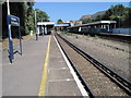
Pokesdown for Boscombe railway station, Dorset
Opened in 1886 on what became the London & South Western Railway's main line from Southampton to Bournemouth. View east towards Christchurch and Southampton.
Image: © Nigel Thompson
Taken: 9 Jul 2011
0.03 miles
9
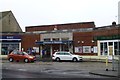
Station entrance
Pokesdown for Boscombe station. Some history here Image and here Image
The A35 Christchurch Road runs past
Image: © David Lally
Taken: 12 Mar 2017
0.03 miles
10

Pokesdown for Boscombe Railway Station
A much-renamed railway station, the present name reflecting its proximity to Boscombe, whose separate station closed in 1965.
Image: © David Martin
Taken: 29 Dec 2022
0.03 miles