IMAGES TAKEN NEAR TO
Exton Road, BOURNEMOUTH, BH6 5QF
Introduction
This page details the photographs taken nearby to Exton Road, BH6 5QF by members of the Geograph project.
The Geograph project started in 2005 with the aim of publishing, organising and preserving representative images for every square kilometre of Great Britain, Ireland and the Isle of Man.

There are currently over 7.5m images from over14,400 individuals and you can help contribute to the project by visiting https://www.geograph.org.uk
Image Map
Images are licensed for reuse under creativecommons.org/licenses/by-sa/2.0
Notes
- Clicking on the map will re-center to the selected point.
- The higher the marker number, the further away the image location is from the centre of the postcode.
Image Listing (48 Images Found)
Images are licensed for reuse under creativecommons.org/licenses/by-sa/2.0
Image
Details
Distance
1
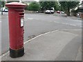
Iford: postbox № BH6 275, Exton Road
Looking east along Exton Road past this postbox, towards the crossroads with Clingan Road.
Image: © Chris Downer
Taken: 19 Jul 2008
0.06 miles
2
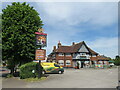
The Cranleigh, Iford, near Bournemouth
The Cranleigh pub in Iford, in the north-eastern suburbs of Bournemouth.
Image: © Malc McDonald
Taken: 21 Jun 2022
0.09 miles
3
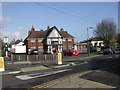
The Cranleigh, Southbourne
Greene King-owned; between the wars estate pub, square with large central bar & several rooms; at my visit, the only cask beer on tap was IPA.
Image: © Mike Faherty
Taken: 8 Nov 2008
0.09 miles
4
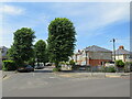
Southwick Road, Iford, near Bournemouth
Southwick Road is a residential road in Iford, a suburb of Bournemouth.
Image: © Malc McDonald
Taken: 21 Jun 2022
0.12 miles
5
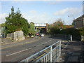
Southwick Road railway bridge
Southwick Road passes here under the Bournemouth-Christchurch railway line; the road has been narrowed to allow pavement on both sides, and is controlled by traffic lights.
Image: © Mike Faherty
Taken: 8 Nov 2008
0.12 miles
7
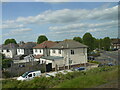
Houses in Iford
This is the back of houses in Southwick Rd close to the junction with Clingan Road, taken from a train on the South West Main Line just east of Pokesdown Station.
Image: © Nigel Mykura
Taken: 7 Jun 2015
0.12 miles
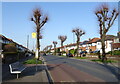
9
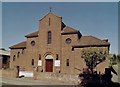
St. Thomas More Roman Catholic Church, Iford
Erected in 1939.
Image: © Michael FORD
Taken: Unknown
0.13 miles