
IMAGES TAKEN NEAR TO
Ashford Road, BOURNEMOUTH, BH6 5QD
Introduction
This page details the photographs taken nearby to Ashford Road, BH6 5QD by members of the Geograph project.
The Geograph project started in 2005 with the aim of publishing, organising and preserving representative images for every square kilometre of Great Britain, Ireland and the Isle of Man.

There are currently over 7.5m images from over14,400 individuals and you can help contribute to the project by visiting https://www.geograph.org.uk
Image Map
Images are licensed for reuse under creativecommons.org/licenses/by-sa/2.0
Notes
- Clicking on the map will re-center to the selected point.
- The higher the marker number, the further away the image location is from the centre of the postcode.
Image Listing (81 Images Found)
Images are licensed for reuse under creativecommons.org/licenses/by-sa/2.0
Image
Details
Distance
1
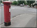
Iford: postbox № BH6 275, Exton Road
Looking east along Exton Road past this postbox, towards the crossroads with Clingan Road.
Image: © Chris Downer
Taken: 19 Jul 2008
0.08 miles
2

Iford roundabout
This was the junction of the trolleybus routes from Iford into Bournemouth. Service 32 was the long way round, via Castle Lane and Charminster Road.
Image: © Alan Murray-Rust
Taken: 31 Mar 1966
0.09 miles
3
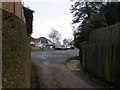
Iford: Water Lane reaches Iford Lane
Water Lane is a public right of way, a byway open to all traffic (or B.O.A.T.) number I05, leading from Iford Lane to Old Bridge Road, which latter is, I believe, the historic course of Iford Lane before it was rerouted for motorised traffic.
Here, we see it as it reaches Iford Lane, opposite Corhampton Road. A car has just turned into Corhampton Road and is reversing to let someone come through between parked cars.
See Image for the view down the lane from across the road ahead, and Image for the next view behind us, with links to further photos.
Image: © Chris Downer
Taken: 8 Jan 2017
0.09 miles
4
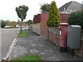
Iford: postbox № BH6 170, Ashford Road
An Elizabeth II-reign postbox at the northern end of Ashford Road. Alongside is a large drop-box, a depository for the postman doing morning deliveries to store part of his round.
Image: © Chris Downer
Taken: 25 Oct 2008
0.10 miles
5
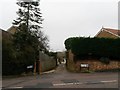
Iford: Water Lane from Iford Lane
Water Lane is a public right of way, a byway open to all traffic (or B.O.A.T.) number I05, leading from Iford Lane to Old Bridge Road, which latter is, I believe, the historic course of Iford Lane before it was rerouted for motorised traffic.
Here, we see it from across Iford Lane as it heads down to the Stour at Old Bridge Road.
See Image for the next photo on the route, with links to further photos.
Image: © Chris Downer
Taken: 8 Jan 2017
0.10 miles
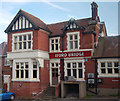
7
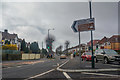
Bournemouth : Christchurch Road A35
Looking along Christchurch Road in Bournemouth.
Image: © Lewis Clarke
Taken: 27 Mar 2018
0.11 miles
8
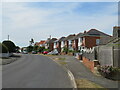
Iford Lane, Iford, near Bournemouth
Iford Lane in Iford, on the north-eastern fringes of Bournemouth.
Image: © Malc McDonald
Taken: 21 Jun 2022
0.11 miles
10
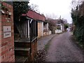
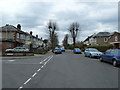
Iford: passing 3 Water Lane
Water Lane is a public right of way, a byway open to all traffic (or B.O.A.T.) number I05, leading from Iford Lane to Old Bridge Road, which latter is, I believe, the historic course of Iford Lane before it was rerouted for motorised traffic.
Here, we look down it as it heads for Old Bridge Road - the parked cars visible in the distance are right alongside the old bridge.
See Image for the next photo on the lane ahead, and Image for the next view behind us - each with links to further photos.
Image: © Chris Downer
Taken: 8 Jan 2017
0.11 miles