
IMAGES TAKEN NEAR TO
Padfield Close, BOURNEMOUTH, BH6 5LU
Introduction
This page details the photographs taken nearby to Padfield Close, BH6 5LU by members of the Geograph project.
The Geograph project started in 2005 with the aim of publishing, organising and preserving representative images for every square kilometre of Great Britain, Ireland and the Isle of Man.

There are currently over 7.5m images from over14,400 individuals and you can help contribute to the project by visiting https://www.geograph.org.uk
Image Map
Images are licensed for reuse under creativecommons.org/licenses/by-sa/2.0
Notes
- Clicking on the map will re-center to the selected point.
- The higher the marker number, the further away the image location is from the centre of the postcode.
Image Listing (64 Images Found)
Images are licensed for reuse under creativecommons.org/licenses/by-sa/2.0
Image
Details
Distance
1
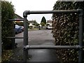
Tuckton: the railings on footpath I21 frame footpath I22
This short public footpath, number I21, runs from the circular Northey Road (behind us) to the dead end of Padfield Close, a cul-de-sac which projects inside the Northey circle. A similar path, I22, does likewise from the opposite side and can be seen directly ahead.
See Image for the next view on the path behind us, and Image for the next photo along path I22 ahead - each with links to further photos on the routes.
Image: © Chris Downer
Taken: 8 Jan 2017
0.01 miles
2
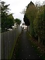
Tuckton: towards Northey Road on footpath I22
This short public footpath runs from the circular Northey Road (ahead) to the dead end of Padfield Close, a cul-de-sac which projects inside the Northey circle. A similar path does likewise from the opposite side.
See Image for the next view on the path ahead, and Image for the next photo behind us - each with links to further photos on the route.
Image: © Chris Downer
Taken: 8 Jan 2017
0.02 miles
3
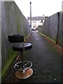
Tuckton: swivelling chair on footpath I22
A change from the usual wooden bench, a swivelling chair has been abandoned on this short public footpath, which runs from the circular Northey Road (ahead) to the dead end of Padfield Close, a cul-de-sac which projects inside the Northey circle. A similar path does likewise from the opposite side.
See Image for the view along the path from the road ahead, and Image for the next photo behind us, with links to further photos on the route.
Image: © Chris Downer
Taken: 8 Jan 2017
0.02 miles
4
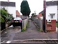
Tuckton: footpath I22 and a nice clean car
This short public footpath runs from here on the circular Northey Road to the dead end of Padfield Close, a cul-de-sac which projects inside the Northey circle. A similar path does likewise from the opposite side.
Meanwhile, the resident of the neighbouring house is in the process of washing his car.
See Image for the next photo on the path, with links to further photos on the route.
Image: © Chris Downer
Taken: 8 Jan 2017
0.02 miles
5
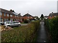
Tuckton: footpath I21 reaches Padfield Close
This short public footpath runs from the circular Northey Road (behind us) to the dead end of Padfield Close, a cul-de-sac which projects inside the Northey circle. A similar path does likewise from the opposite side, as can be seen ahead.
See Image for the view behind us, and Image for the next photo along the path ahead - each with links to further photos on the routes.
Image: © Chris Downer
Taken: 8 Jan 2017
0.02 miles
6
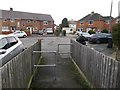
Tuckton: footpath I22 arrives on Padfield Close
This short public footpath runs from the circular Northey Road (behind us) to the dead end of Padfield Close, a cul-de-sac which projects inside the Northey circle. A similar path, I21, does likewise from the opposite side and can be seen directly ahead.
See Image for the next view on the path behind us, and Image for the next photo along path I21 ahead - each with links to further photos on the routes.
Image: © Chris Downer
Taken: 8 Jan 2017
0.02 miles
7
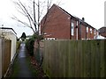
Tuckton: eastbound on footpath I21
This short public footpath runs from the circular Northey Road (behind us) to the dead end of Padfield Close, a cul-de-sac which projects inside the Northey circle. A similar path does likewise from the opposite side.
See Image for the view behind us, and Image for the next photo along the path ahead, with links to further photos on the route.
Image: © Chris Downer
Taken: 8 Jan 2017
0.03 miles
8
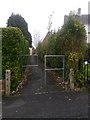
Tuckton: footpath I21 to Padfield Close
This short public footpath runs from the circular Northey Road to the dead end of Padfield Close, a cul-de-sac which projects inside the Northey circle. A similar path does likewise from the far side.
See Image for the next photo along the path, with links to further photos on the route.
Image: © Chris Downer
Taken: 8 Jan 2017
0.04 miles
9
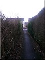
Tuckton: westbound on footpath I21
This short public footpath runs from the circular Northey Road (ahead) to the dead end of Padfield Close, a cul-de-sac which projects inside the Northey circle. A similar path does likewise from the opposite side.
See Image for a view along the path from ahead, and Image for the next photo along the path behind us, with links to further photos on the route.
Image: © Chris Downer
Taken: 8 Jan 2017
0.05 miles
10
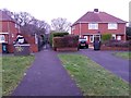
Tuckton: footpath I23 from Northey Road
This public footpath has come up from Iford Lane, through The Rookery, a wooded open space, and arrives here on the northern corner of Northey Road. The bend of the carriageway here is gentler than the curve of the frontages, so there is a crescent shaped grass patch filling the gap, with a pavement around both the roadside and outside edges.
See Image for the next view on the path ahead, with links to further photos along the public footpath.
Image: © Chris Downer
Taken: 8 Jan 2017
0.06 miles