
IMAGES TAKEN NEAR TO
Inverleigh Road, BOURNEMOUTH, BH6 5HB
Introduction
This page details the photographs taken nearby to Inverleigh Road, BH6 5HB by members of the Geograph project.
The Geograph project started in 2005 with the aim of publishing, organising and preserving representative images for every square kilometre of Great Britain, Ireland and the Isle of Man.

There are currently over 7.5m images from over14,400 individuals and you can help contribute to the project by visiting https://www.geograph.org.uk
Image Map
Images are licensed for reuse under creativecommons.org/licenses/by-sa/2.0
Notes
- Clicking on the map will re-center to the selected point.
- The higher the marker number, the further away the image location is from the centre of the postcode.
Image Listing (74 Images Found)
Images are licensed for reuse under creativecommons.org/licenses/by-sa/2.0
Image
Details
Distance
1
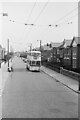
Trolleybus on Beaufort Road ? 1969
On service 23 from Tuckton Bridge via Cranleigh Road, taken on the last day of normal trolleybus operation in Bournemouth.
This is one of a series of views featuring buses in the 60s, 70s, and 80s. http://www.geograph.org.uk/search.php?i=137652761
Image: © Alan Murray-Rust
Taken: 19 Apr 1969
0.05 miles
3
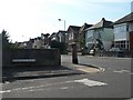
West Southbourne: postbox № BH6 203, Beaufort Road
A George V-reign postbox on the corner of Beaufort and Burleigh Roads.
Image: © Chris Downer
Taken: 20 Sep 2008
0.07 miles
4
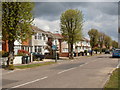
Southbourne, Castleman Avenue
1920s housing on the western side of the Beaufort Estate.
Image: © Mike Faherty
Taken: 3 May 2010
0.08 miles
5
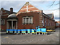
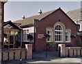
West Southbourne: Stourfield Infant School playground
Looking into the grounds of Image, showing detail of the stonework on the porch bearing the words "Infants' School".
Image: © Chris Downer
Taken: 2 Feb 2008
0.08 miles
6
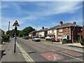
Cranleigh Road, Southbourne
Cranleigh Road is a residential road in Southbourne, in the eastern suburbs of Bournemouth. The raised humps in the foreground are speed cushions which have been installed as a traffic-calming measure.
Image: © Malc McDonald
Taken: 21 Jun 2022
0.08 miles
7
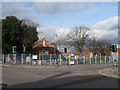
West Southbourne: Stourfield Infant School
Looking across the junction of Cranleigh and Beaufort Roads to Stourfield Infant School, which caters for children aged 4-7 before they move up to the Junior School next door.
Image: © Chris Downer
Taken: 2 Feb 2008
0.08 miles
8
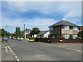
Stamford Road, Southbourne
Stamford Road is a residential road in Southbourne, in the eastern suburbs of Bournemouth. The roads in this neighbourhood are laid out in a grid pattern, with straight streets intersecting at right angles.
Image: © Malc McDonald
Taken: 21 Jun 2022
0.10 miles
9
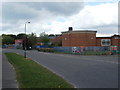
Southbourne, community centre
Beaufort Community Centre, on Beaufort Road. http://www.beaufortcommunitycentre.com/aboutus.html#
Image: © Mike Faherty
Taken: 3 May 2010
0.10 miles
10
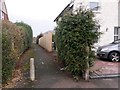
West Southbourne: footpath I02 to Lingdale Road
This short public footpath heads through from Cranleigh Road to the minor parallel Lingdale Road.
See Image for the next photo on the path, with links to further photos along the route.
Image: © Chris Downer
Taken: 8 Jan 2017
0.11 miles