IMAGES TAKEN NEAR TO
Arnewood Road, BOURNEMOUTH, BH6 5DW
Introduction
This page details the photographs taken nearby to Arnewood Road, BH6 5DW by members of the Geograph project.
The Geograph project started in 2005 with the aim of publishing, organising and preserving representative images for every square kilometre of Great Britain, Ireland and the Isle of Man.

There are currently over 7.5m images from over14,400 individuals and you can help contribute to the project by visiting https://www.geograph.org.uk
Image Map
Images are licensed for reuse under creativecommons.org/licenses/by-sa/2.0
Notes
- Clicking on the map will re-center to the selected point.
- The higher the marker number, the further away the image location is from the centre of the postcode.
Image Listing (92 Images Found)
Images are licensed for reuse under creativecommons.org/licenses/by-sa/2.0
Image
Details
Distance
1

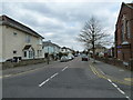
West Southbourne: parish church of St. Christopher
Image: © Chris Downer
Taken: Unknown
0.03 miles
2
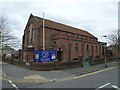
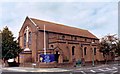
St Christopher, West Southbourne: April 1913
Image: © Basher Eyre
Taken: 5 Apr 2013
0.03 miles
3
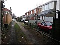
West Southbourne: footpath H16 heads for Arnewood Road
This public footpath is essentially a rear driveway for the shops on Cranleigh Road (to the right) and leads from Irving Road (behind us) to Arnewood Road (ahead).
See Image for the next view of the path ahead, and Image for the next behind us, with links to further photos along the route.
Image: © Chris Downer
Taken: 8 Jan 2017
0.03 miles
4

West Southbourne: footpath H16 from Arnewood Road
This public footpath is essentially a rear driveway for the shops on Cranleigh Road (to the left) and leads from here in Arnewood Road to Irving Road.
See Image for the next view on the path, with links to further photos along the route.
Image: © Chris Downer
Taken: 8 Jan 2017
0.03 miles
6
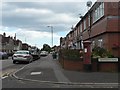
West Southbourne: postbox № BH6 286, Cranleigh Road
The postbox was moved to the corner of Arnewood Road from the shops a few doors down, when Cranleigh Road Post Office closed on 9 February 2004.
Image: © Chris Downer
Taken: 19 Jul 2008
0.04 miles
7
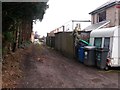
West Southbourne: halfway along footpath H16
This public footpath is essentially a rear driveway for the shops on Cranleigh Road (to the right) and leads from Irving Road (behind us) to Arnewood Road (ahead).
See Image for the next view of the path ahead, and Image for the next behind us - each with links to further photos along the route.
Image: © Chris Downer
Taken: 8 Jan 2017
0.04 miles
8
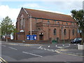
Southbourne, St. Christopher's
Parish church at the junction of Burleigh and Arnewood Roads; hoppers are dated 1933. http://www.saint-christophers.org.uk/stc/
Image: © Mike Faherty
Taken: 3 May 2010
0.05 miles
9
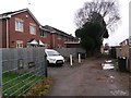
West Southbourne: 98a and 98b Irving Road
This is public footpath H16, essentially a rear driveway for the shops on Cranleigh Road (just to the right) and leads from Irving Road (behind us) to Arnewood Road (ahead).
The houses on the left are an infill development at the rear of 98 Irving Road and are therefore numbered 98a and 98b. They appear to be part of the same development as the next houses beyond, which are part of Dukes Close and accessed from another nearby side-road.
See Image for the next view of the path behind us, and Image for the view towards us from just ahead, with links to further photos along the route.
Image: © Chris Downer
Taken: 8 Jan 2017
0.06 miles