
IMAGES TAKEN NEAR TO
Boreham Road, BOURNEMOUTH, BH6 5BW
Introduction
This page details the photographs taken nearby to Boreham Road, BH6 5BW by members of the Geograph project.
The Geograph project started in 2005 with the aim of publishing, organising and preserving representative images for every square kilometre of Great Britain, Ireland and the Isle of Man.

There are currently over 7.5m images from over14,400 individuals and you can help contribute to the project by visiting https://www.geograph.org.uk
Image Map
Images are licensed for reuse under creativecommons.org/licenses/by-sa/2.0
Notes
- Clicking on the map will re-center to the selected point.
- The higher the marker number, the further away the image location is from the centre of the postcode.
Image Listing (79 Images Found)
Images are licensed for reuse under creativecommons.org/licenses/by-sa/2.0
Image
Details
Distance
1
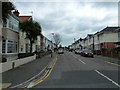
Looking from Arnewood Road into Burleigh Road
Image: © Basher Eyre
Taken: 5 Apr 2013
0.03 miles
2
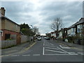
Looking from Burleigh Road into Arnewood Road
Image: © Basher Eyre
Taken: 5 Apr 2013
0.04 miles
3
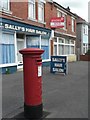
West Southbourne: postbox № BH6 94, Kimberley Road
Kimberley Road did have a post office till 25 October 2000 although it was never in either of the premises, 86 and 88, pictured here. Large-scale maps show the post office as having been at number 76 with the postbox outside it, so it has probably been moved here since.
Image: © Chris Downer
Taken: 19 Jul 2008
0.05 miles
4
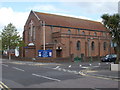
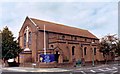
Southbourne, St. Christopher's
Parish church at the junction of Burleigh and Arnewood Roads; hoppers are dated 1933. http://www.saint-christophers.org.uk/stc/
Image: © Mike Faherty
Taken: 3 May 2010
0.06 miles
5
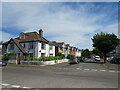
Fenton Road, Southbourne
Fenton Road is a residential road in Southbourne, in the eastern suburbs of Bournemouth. The roads in this neighbourhood are laid out in a grid pattern, with straight streets intersecting at right angles.
Image: © Malc McDonald
Taken: 21 Jun 2022
0.07 miles
8
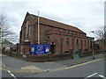
St Christopher, West Southbourne: April 1913
Image: © Basher Eyre
Taken: 5 Apr 2013
0.08 miles
9

West Southbourne: parish church of St. Christopher
Image: © Chris Downer
Taken: Unknown
0.08 miles
10
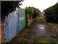
West Southbourne: blue and green gates on footpath H14
This is one of seven public footpaths running parallel with and either side of Kimberley Road, serving as rear driveway access to the properties on that road. Complementing the criss-cross arrangements of roads in West Southbourne, they are arranged in the following order:
(northeast side of Kimberley Road)
Castlemain Avenue - footpath H09 - Beaufort Road - footpath H10 - Stamford Road - footpath H13 - Arnewood Road - footpath H14 - Irving Road
(southwest side of Kimberley Road)
Beaufort Road - footpath H11 - Stamford Road - footpath H12 - Arnewood Road - footpath H15 [called Irving Lane] - Irving Road
Here, we look along footpath H14 towards Irving Road, past a rear entrance featuring a pair of wooden gates, one blue and one green.
See Image for the next view on the path ahead, and Image for the next view behind us - each with links to further photos along the route.
Image: © Chris Downer
Taken: 8 Jan 2017
0.09 miles