
IMAGES TAKEN NEAR TO
New Park Road, BOURNEMOUTH, BH6 5AB
Introduction
This page details the photographs taken nearby to New Park Road, BH6 5AB by members of the Geograph project.
The Geograph project started in 2005 with the aim of publishing, organising and preserving representative images for every square kilometre of Great Britain, Ireland and the Isle of Man.

There are currently over 7.5m images from over14,400 individuals and you can help contribute to the project by visiting https://www.geograph.org.uk
Image Map
Images are licensed for reuse under creativecommons.org/licenses/by-sa/2.0
Notes
- Clicking on the map will re-center to the selected point.
- The higher the marker number, the further away the image location is from the centre of the postcode.
Image Listing (138 Images Found)
Images are licensed for reuse under creativecommons.org/licenses/by-sa/2.0
Image
Details
Distance
1

Southbourne: footpath H05 arrives on New Park Road
This public footpath, a narrow passageway, arrives onto New Park Road from Southbourne Grove - see Image for the view along the path from across the road, and Image for the view along the path from behind us.
Image: © Chris Downer
Taken: 21 Jul 2016
0.02 miles
2

Southbourne: bumper-to-bumper parking on New Park Road
Looking across New Park Road along public footpath H05 to Southbourne Grove. Just in front of us, two cars are parked literally within an inch of each other - parking can often be tight in these turn-of-the-20th-century streets, whose houses were built long before the anticipation of every household having a car to put somewhere.
See Image for the view towards us from along the path.
Image: © Chris Downer
Taken: 21 Jul 2016
0.02 miles
3
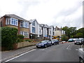
Southbourne, building site
On New Park Road; the site does not seem to be at the stage to give it a name.
Image: © Mike Faherty
Taken: 10 Aug 2014
0.03 miles
4

Southbourne: midway along footpath H05
This public footpath doubles as a bin-store access for the neighbouring shops (and flats above) on Southbourne Grove.
See Image for the view from the end of the path behind us, and Image for the emergence onto New Park Road ahead.
Image: © Chris Downer
Taken: 21 Jul 2016
0.03 miles
5

Southbourne: footpath H05 to New Park Road
A narrow public footpath between two tall buildings, leading from Southbourne Grove to New Park Road, which runs behind.
See Image for the next view along the path.
Image: © Chris Downer
Taken: 21 Jul 2016
0.04 miles
6
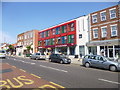
Southbourne, Sainsbury's Local
Store on Southbourne Grove.
Image: © Mike Faherty
Taken: 25 Jul 2014
0.04 miles
7
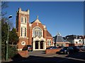
Trinity Methodist Church
Another view of Image on Southbourne Road, with a distinctive hexagonal cone-shaped roof to the adjacent hall.
Image: © Derek Harper
Taken: 10 Mar 2010
0.04 miles
8
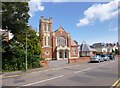
Southbourne, Trinity Methodist Church
On Southbourne Road; apparently, one of the few Methodist churches to be named after an event rather than a location. Church hall, with turret, to the right. http://www.bournemouthmethodistcircuit.org.uk/our-churches/trinity/
Image: © Mike Faherty
Taken: 10 Aug 2014
0.04 miles
9
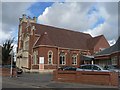
Southbourne: Methodist Church
Situated on Southbourne Road, between nos. 84 and 86.
Image: © Chris Downer
Taken: 9 Mar 2008
0.04 miles
10

Delivery van on Southbourne Grove
This van from the company Greenleaf which provides plants and things like christmas trees to shops and businesses was parked outside the premises of Ludo which is a lounge cafe bar. the phone number on the van is 029 2080 9090.
Image: © Nigel Mykura
Taken: 6 Mar 2019
0.05 miles