IMAGES TAKEN NEAR TO
Stevenson Road, BOURNEMOUTH, BH6 4DB
Introduction
This page details the photographs taken nearby to Stevenson Road, BH6 4DB by members of the Geograph project.
The Geograph project started in 2005 with the aim of publishing, organising and preserving representative images for every square kilometre of Great Britain, Ireland and the Isle of Man.

There are currently over 7.5m images from over14,400 individuals and you can help contribute to the project by visiting https://www.geograph.org.uk
Image Map
Images are licensed for reuse under creativecommons.org/licenses/by-sa/2.0
Notes
- Clicking on the map will re-center to the selected point.
- The higher the marker number, the further away the image location is from the centre of the postcode.
Image Listing (94 Images Found)
Images are licensed for reuse under creativecommons.org/licenses/by-sa/2.0
Image
Details
Distance
1
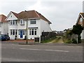
Southbourne: eastern end of the former Admiralty Road
Admiralty Road is a public right of way, number I07, designated as a Byway Open to All Traffic (or B.O.A.T.) at its northern end. This previously applied to the whole length of the road, but the road has been truncated now and the designation of the right of way truncated even more.
Here, we are looking along the eastern stub of the road, no longer a through route nor a right of way. See Image for the next view ahead, towards the continuing defunct course of the road - with links to further photos along the defunct and extant segments.
Image: © Chris Downer
Taken: 11 Feb 2017
0.01 miles
2
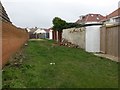
Southbourne: footpath I24 is a rear access
This little public footpath opens out from a short narrow path, behind us, onto this rear driveway for the Stevenson Road properties on the right. It ends just ahead at the defunct part of Admiralty Road. Access is available onto Stevenson Road from there, but the actual public right of way appears to only now encompass this stretch.
See Image for the view behind us, and Image for the view towards us from the end of the driveway.
See Image for more discussion on the old Admiralty Road.
Image: © Chris Downer
Taken: 11 Feb 2017
0.02 miles
3
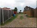
Southbourne: footpath I24 from its northern end
This little public footpath opens out from a short narrow path, ahead, onto this rear driveway for the Stevenson Road properties on the left. It ends just here at the defunct part of Admiralty Road, which runs left-to-right at our feet. Access is available onto Stevenson Road along it, but the actual public right of way appears to only now encompass this stretch ahead.
See Image for the view towards us from the fence ahead.
See Image for the view along the Admiralty Road segment from our left, and more discussion on the defunct route.
Image: © Chris Downer
Taken: 11 Feb 2017
0.02 miles
5
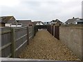
Southbourne: peeking over a fence on the former Admiralty Road
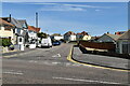
Admiralty Road is a public right of way, number I07, designated as a Byway Open to All Traffic (or B.O.A.T.) at its northern end. This previously applied to the whole length of the road, but the road has been truncated now and the designation of the right of way truncated even more.
Here, we are looking along the defunct part of the route, which appears still to have some kind of function as a driveway.
See Image for the view towards us from the next visible part of the road, with links to further pictures along the remaining section.
Meanwhile, see Image for a view to the gateway over which we are looking, from behind us.
Image: © Chris Downer
Taken: 11 Feb 2017
0.02 miles
6
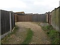
Southbourne: the old bit of Admiralty Road ends
Admiralty Road is a public right of way, number I07, designated as a Byway Open to All Traffic (or B.O.A.T.) at its northern end. This previously applied to the whole length of the road, but the road has been truncated now and the designation of the right of way truncated even more.
Here, we are looking along the stub of the eastern end, no longer a through route nor a right of way. See Image for the view over the gate ahead, towards the continuing defunct course of the road - with links to further photos along the defunct and extant segments.
Meanwhile, see Image for a view from the end of the road behind us.
Incidentally, the driveway, starting here and heading around to the left, is a public footpath onto Southbourne Coast Road - see Image
Image: © Chris Downer
Taken: 11 Feb 2017
0.02 miles
7

Southbourne: footpath I24 from Southbourne Coast Road
This little public footpath opens out onto a rear driveway for the Stevenson Road properties on the right, and ends at the defunct part of Admiralty Road. Access is available onto Stevenson Road from there, but the actual public right of way appears to only now encompass the rear of the houses.
See Image for the next view on the path ahead.
See Image for more discussion on the old Admiralty Road.
Image: © Chris Downer
Taken: 11 Feb 2017
0.03 miles
8

Southbourne: footpath I24 emerges
This little public footpath opens out behind us onto a rear driveway for the Stevenson Road properties on the left, and ends at the defunct part of Admiralty Road. Access is available onto Stevenson Road from there, but the actual public right of way appears to only now encompass the rear of the houses.
See Image for the view towards us from across the road, and Image for the view behind us.
See Image for more discussion on the old Admiralty Road.
Image: © Chris Downer
Taken: 11 Feb 2017
0.03 miles
9
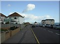
Southbourne Coast Road
From Belle Vue Road to Broadway, following the coast; a few houses to the right obscure the sea view. Hengistbury Head in the distance.
Image: © Mike Faherty
Taken: 12 Sep 2010
0.03 miles