IMAGES TAKEN NEAR TO
Church Road, BOURNEMOUTH, BH6 4AS
Introduction
This page details the photographs taken nearby to Church Road, BH6 4AS by members of the Geograph project.
The Geograph project started in 2005 with the aim of publishing, organising and preserving representative images for every square kilometre of Great Britain, Ireland and the Isle of Man.

There are currently over 7.5m images from over14,400 individuals and you can help contribute to the project by visiting https://www.geograph.org.uk
Image Map (Loading...)


Getting Data...Please wait
Leaflet Map data © OpenStreetMap
Images are licensed for reuse under creativecommons.org/licenses/by-sa/2.0
Notes
- Clicking on the map will re-center to the selected point.
- The higher the marker number, the further away the image location is from the centre of the postcode.
Image Listing (208 Images Found)
Images are licensed for reuse under creativecommons.org/licenses/by-sa/2.0
Image
Details
Distance
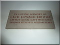
2
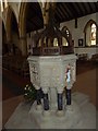
St. Katharine, Southbourne: war memorial (1)
Image: © Basher Eyre
Taken: 5 Apr 2013
0.04 miles
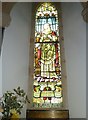
3
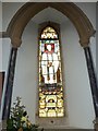
St. Katharine, Southbourne: stained glass window (iv)
Image: © Basher Eyre
Taken: 5 Apr 2013
0.04 miles
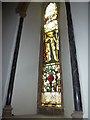
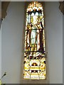
4
St. Katharine, Southbourne: stained glass window (viii)
Image: © Basher Eyre
Taken: 5 Apr 2013
0.04 miles
5
St. Katharine, Southbourne: stained glass window (ix)
Image: © Basher Eyre
Taken: 5 Apr 2013
0.04 miles
6
St. Katharine, Southbourne: stained glass window (xi)
Image: © Basher Eyre
Taken: 5 Apr 2013
0.04 miles
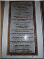
7
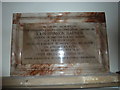
St. Katharine, Southbourne: memorial (5)
Image: © Basher Eyre
Taken: 5 Apr 2013
0.04 miles
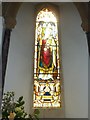
10
St Katherine, Southbourne: stained glass window (xvii)
This one is of John Keble http://en.wikipedia.org/wiki/John_Keble
Image: © Basher Eyre
Taken: 5 Apr 2013
0.04 miles