
IMAGES TAKEN NEAR TO
Seafield Road, BOURNEMOUTH, BH6 3JD
Introduction
This page details the photographs taken nearby to Seafield Road, BH6 3JD by members of the Geograph project.
The Geograph project started in 2005 with the aim of publishing, organising and preserving representative images for every square kilometre of Great Britain, Ireland and the Isle of Man.

There are currently over 7.5m images from over14,400 individuals and you can help contribute to the project by visiting https://www.geograph.org.uk
Image Map
Images are licensed for reuse under creativecommons.org/licenses/by-sa/2.0
Notes
- Clicking on the map will re-center to the selected point.
- The higher the marker number, the further away the image location is from the centre of the postcode.
Image Listing (123 Images Found)
Images are licensed for reuse under creativecommons.org/licenses/by-sa/2.0
Image
Details
Distance
1

Seafield Gardens and water tower, Southbourne, near Bournemouth
Seafield gardens is a small park in Southbourne, a suburb of Bournemouth. A water tower stands in the centre of the gardens.
This image was taken shortly after midday on New Year's Day 2026. The sun was shining but at this time of year, it is low in the sky resulting in some long shadows.
Image: © Malc McDonald
Taken: 1 Jan 2026
0.05 miles
2
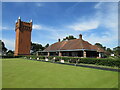
Bowling club and water tower, Seafield Gardens, Southbourne
A bowling club and pavilion in Seafield Gardens, in the eastern suburbs of Bournemouth. Overlooking the bowling club is a water tower.
Image: © Malc McDonald
Taken: 21 Jun 2022
0.07 miles
3
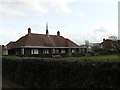
Seafield Gardens: pavilion and bowling green
One of two bowling greens in Seafield Gardens – the other is behind the pavilion and pictured here: Image The pavilion is also open to the public as a small café, although it wasn't today.
Image: © Chris Downer
Taken: 2 Feb 2008
0.07 miles
4
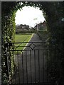
Seafield Gardens: Green Flag
The Green Flag flies at Seafield Gardens alongside one of the bowling greens, meaning that the gardens have revceived an award for outstanding open spaces.
Image: © Chris Downer
Taken: 2 Feb 2008
0.07 miles
5
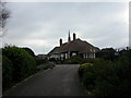
Cafe & pavilion, Seafield Gardens
The gardens (mainly tennis courts & a bowling green) were built in the late 1900s on a site at the top of Belle Vue Hill, overlooking the Stour. The cafe was added in 1911; today it is shuttered up for the winter.
http://www.bournemouth.gov.uk/Visitors/Parks_Gardens_Countryside/seafield_gardens/History_of_Seafield_Gardens.asp
Image: © Mike Faherty
Taken: 3 Nov 2008
0.07 miles
6
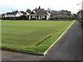
Seafield Gardens: bowling green
One of two bowling greens at Seafield Gardens.
Image: © Chris Downer
Taken: 2 Feb 2008
0.08 miles
7
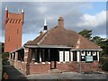
Seafield Gardens: pavilion and water tower
For more discussion on the water tower, see Image
Image: © Chris Downer
Taken: 2 Feb 2008
0.08 miles
8

Water tower, Southbourne
As seen from Seafield Road; built 1898 by the West Hants Water Company.
http://www.bournemouth.gov.uk/Visitors/Parks_Gardens_Countryside/seafield_gardens/History_of_Seafield_Gardens.asp
Image: © Mike Faherty
Taken: 3 Nov 2008
0.09 miles
9
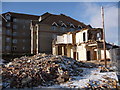
Southbourne: another pub gone
The Southbourne Cliffs pub is in the final stages of demolition. It will not be the most sorely missed, either architecturally from what I recall or socially from what I've heard. Nevertheless, another pub that is no more.
Image: © Chris Downer
Taken: 18 Dec 2010
0.10 miles
10
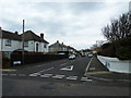
Looking from Douglas Road into Wayside Road
Image: © Basher Eyre
Taken: 5 Apr 2013
0.10 miles