
IMAGES TAKEN NEAR TO
Tuckton Close, BOURNEMOUTH, BH6 3HY
Introduction
This page details the photographs taken nearby to Tuckton Close, BH6 3HY by members of the Geograph project.
The Geograph project started in 2005 with the aim of publishing, organising and preserving representative images for every square kilometre of Great Britain, Ireland and the Isle of Man.

There are currently over 7.5m images from over14,400 individuals and you can help contribute to the project by visiting https://www.geograph.org.uk
Image Map
Images are licensed for reuse under creativecommons.org/licenses/by-sa/2.0
Notes
- Clicking on the map will re-center to the selected point.
- The higher the marker number, the further away the image location is from the centre of the postcode.
Image Listing (63 Images Found)
Images are licensed for reuse under creativecommons.org/licenses/by-sa/2.0
Image
Details
Distance
1
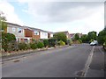
Southbourne, Kirby Way
Modern suburban housing on a cul-de-sac off Tuckton Close.
Image: © Mike Faherty
Taken: 18 Aug 2014
0.04 miles
2
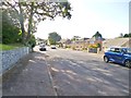
Southbourne, Leigham Vale Road
Suburban road from Seafield Road to Carbery Avenue.
Image: © Mike Faherty
Taken: 20 Aug 2014
0.08 miles
3
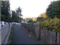
Tuckton: footpath I09 approaches Seafield Road
This public footpath between Seafield and Tuckton Roads forms a quite generous short-cut compared to the road route. We see it here at its northern end, arriving on Seafield Road almost opposite the turning of Leigham Vale Road.
See Image for view towards us from the road ahead, and Image for the next view behind us, and links to further photos along the path.
Image: © Chris Downer
Taken: 22 Oct 2016
0.10 miles
4
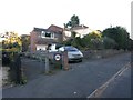
Tuckton: footpath I09 to Tuckton Road
This public footpath heads for Tuckton Roads and forms a quite generous short-cut compared to the road route.
See Image for the view towards us from a short way along the path, and links to further photos along the path.
Image: © Chris Downer
Taken: 22 Oct 2016
0.10 miles
5
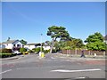
Southbourne, pine tree
On Tuckton Road. Bournemouth's reputation as a resort was partially based on the number of pine trees, whose vapour was reputed to have health benefits. This specimen looks likely to face the chop in the near future.
Image: © Mike Faherty
Taken: 13 Aug 2014
0.10 miles
6

Seafield Road, Southbourne, Bournemouth
Seafield Road is a residential road in Southbourne, a suburb of Bournemouth. This section of the road lies within the Carbery Estate.
This image was taken shortly after midday on New Year's Day 2026.
Image: © Malc McDonald
Taken: 1 Jan 2026
0.10 miles
7
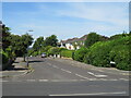
Seafield Road, Southbourne
Seafield Road is a minor residential road in Southbourne, in the eastern suburbs of Bournemouth.
Image: © Malc McDonald
Taken: 21 Jun 2022
0.10 miles
8
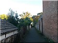
Tuckton: footpath I09 heads for Tuckton Road
This public footpath from Seafield Road heads for Tuckton Road and forms a quite generous short-cut compared to the road route.
See Image for next view on the path ahead, and Image for the next view behind us - each with links to further photos along the path.
Image: © Chris Downer
Taken: 22 Oct 2016
0.11 miles
9
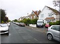
Southbourne, Heatherlea Road
Suburban road linking Hathaway and Belle Vue Roads.
Image: © Mike Faherty
Taken: 25 Aug 2014
0.11 miles
10
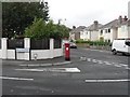
Southbourne: postbox № BH6 62, Hathaway Road
Looking across the turning of Heatherlea Road into Hathaway Road, this Edward VII-reign postbox gracing the corner.
Image: © Chris Downer
Taken: 9 Sep 2008
0.11 miles