
IMAGES TAKEN NEAR TO
Bolton Close, BOURNEMOUTH, BH6 3EB
Introduction
This page details the photographs taken nearby to Bolton Close, BH6 3EB by members of the Geograph project.
The Geograph project started in 2005 with the aim of publishing, organising and preserving representative images for every square kilometre of Great Britain, Ireland and the Isle of Man.

There are currently over 7.5m images from over14,400 individuals and you can help contribute to the project by visiting https://www.geograph.org.uk
Image Map
Images are licensed for reuse under creativecommons.org/licenses/by-sa/2.0
Notes
- Clicking on the map will re-center to the selected point.
- The higher the marker number, the further away the image location is from the centre of the postcode.
Image Listing (182 Images Found)
Images are licensed for reuse under creativecommons.org/licenses/by-sa/2.0
Image
Details
Distance
1
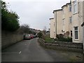
Southbourne: Bolton Close passes Eton Mansions
Bolton Close, on which we stand, forms the majority of a public footpath, number I06, from the end of Bolton Road (ahead), which then continues behind us to reach Belle Vue Road.
Alongside us are two blocks of flats, named Eton Mansions and Windsor Mansions.
See Image for the next view on the path ahead, and Image for the next view behind us - each with links to further views along the path.
Image: © Chris Downer
Taken: 11 Feb 2017
0.01 miles
2
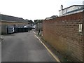
Southbourne: footpath I06 heads for the end of Bolton Close
This public footpath follows the short driveway here, and then goes past the bins and pillars ahead to reach the end Bolton Close, and on to the end of Bolton Road.
See Image for the next view on the path ahead, and Image for the next view behind us - each with links to further views along the path.
Image: © Chris Downer
Taken: 11 Feb 2017
0.01 miles
3
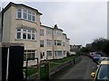
Southbourne: Windsor Mansions
Bolton Close, on which we stand, forms the majority of a public footpath, number I06, from the end of Bolton Road (behind us), which then continues to Belle Vue Road.
Alongside us are two blocks of flats, named Windsor Mansions and, beyond, Eton Mansions.
See Image for the next view on the path ahead, and Image for the next view behind us - each with links to further views along the path.
Image: © Chris Downer
Taken: 11 Feb 2017
0.02 miles
4
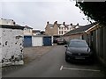
Southbourne: garages at the end of Bolton Close
Bolton Close, on which we stand, forms the majority of a public footpath, number I06, from the end of Bolton Road (behind us), which then heads through the gap ahead to reach Belle Vue Road.
See Image for the next view on the path ahead, and Image for the next view behind us - each with links to further views along the path.
Image: © Chris Downer
Taken: 11 Feb 2017
0.02 miles
5
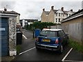
Southbourne: from driveway to driveway on footpath I06
This public footpath comes up the driveway from the main Belle Vue Road, ahead of us, past some metal posts and continues behind us along Bolton Close, which is essentially another little driveway to garages from the dead end of Bolton Road.
See Image for the view towards us from ahead, and Image for the next view on the route behind us.
Image: © Chris Downer
Taken: 22 Jul 2017
0.02 miles
6
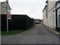
Southbourne: footpath I06 from Belle Vue Road
This driveway leads round to the back of the parades of shops on either side (mainly now converted to residential) and continues as a public footpath along Bolton Close to the end of Bolton Road.
See Image for the next in a series of photos along the path.
Image: © Chris Downer
Taken: 11 Feb 2017
0.02 miles
7
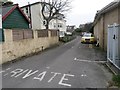
Southbourne: second ?PRIVATE? markings on Bolton Close
Partway along Bolton Close, we pass a second instance of the word PRIVATE on the tarmac as we approach Windsor Mansions. The markings refer only to motorised traffic, though, as Bolton Close forms the majority of a public footpath, number I06, from the end of Bolton Road (behind us), which then heads on to reach Belle Vue Road.
See Image for the next view on the path ahead, and Image for the next view behind us - each with links to further views along the path.
Image: © Chris Downer
Taken: 11 Feb 2017
0.03 miles
8
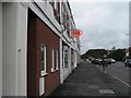
Southbourne: Crossroads Caf
A striking orange teapot hangs outside this café near the junction known as Southbourne Crossroads.
Image: © Chris Downer
Taken: 6 Sep 2008
0.03 miles
9
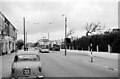
Belle Vue Road, Southbourne, Bournemouth ? 1966
Bournemouth trolleybus 275 makes its way to Tuckton Bridge on service 22.
This is one of a series of views featuring buses in the 60s, 70s, and 80s. http://www.geograph.org.uk/search.php?i=2114547&displayclass=slide
Image: © Alan Murray-Rust
Taken: 30 Aug 1966
0.03 miles
10
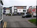
Southbourne: footpath I06 arrives on Belle Vue Road
This driveway leads round to the back of the parades of shops on either side (mainly now converted to residential) and continues as a public footpath along Bolton Close, behind us, to the end of Bolton Road.
See Image for the view towards us from the pavement ahead, and Image for the next in a series of photos along the path behind us.
Image: © Chris Downer
Taken: 11 Feb 2017
0.03 miles