IMAGES TAKEN NEAR TO
Harcourt Road, BOURNEMOUTH, BH5 2JG
Introduction
This page details the photographs taken nearby to Harcourt Road, BH5 2JG by members of the Geograph project.
The Geograph project started in 2005 with the aim of publishing, organising and preserving representative images for every square kilometre of Great Britain, Ireland and the Isle of Man.

There are currently over 7.5m images from over14,400 individuals and you can help contribute to the project by visiting https://www.geograph.org.uk
Image Map
Images are licensed for reuse under creativecommons.org/licenses/by-sa/2.0
Notes
- Clicking on the map will re-center to the selected point.
- The higher the marker number, the further away the image location is from the centre of the postcode.
Image Listing (131 Images Found)
Images are licensed for reuse under creativecommons.org/licenses/by-sa/2.0
Image
Details
Distance
1
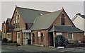
Former Pokesdown Baptist Church
Erected in 1891 for the Baptists but now used as Bournemouth Deaf Centre.
Image: © Michael FORD
Taken: Unknown
0.06 miles
2
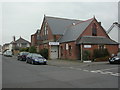
Bournemouth Deaf Centre
Opened 1995 in a converted Baptist church; at the junction of Morley & Harcourt Road, Pokesdown. For details of the centre's history & activities, see http://members.lycos.co.uk/bmthdeafclub/
Image: © Mike Faherty
Taken: 24 Feb 2009
0.07 miles
3
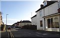
Queensland Road, Pokesdown
What was the reason for choosing this name for the residential road?
Image: © David Smith
Taken: 25 Jan 2018
0.11 miles
4
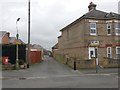
Pokesdown: footpath G03 from Rosebery Road
This public footpath is essentially a rear access driveway for odd numbered shops 881-895 Christchurch Road (to our left) and the flats above. We view it here from the western end, on Rosebery Road, and it runs to Morley Road, the next side turning.
See Image for the next view along the path.
Image: © Chris Downer
Taken: 25 Feb 2017
0.11 miles
5
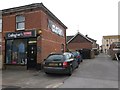
Pokesdown: Gallagher?s Clothing and footpath G03
This public footpath is essentially a rear access driveway for odd numbered shops 881-895 Christchurch Road (to our right) and the flats above. We look along it here from Morley Road and it heads for Rosebery Road.
Meanwhile, the clothing shop occupying the first house in Morley Road is quite unusual, in that there aren't that many shops that spill over into the side roads along here.
See Image for the view towards us from a little way along the path, with links to a few other photos on the route.
Image: © Chris Downer
Taken: 25 Feb 2017
0.12 miles
6
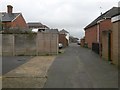
Pokesdown: midway along footpath G03
This public footpath is essentially a rear access driveway for odd numbered shops 881-895 Christchurch Road (to our left) and the flats above. We are midway along it here, from Rosebery Road, behind us, to Morley Road, just ahead.
See Image for the view from the end of the path behind us, and Image for the emergence onto the road ahead.
Image: © Chris Downer
Taken: 25 Feb 2017
0.12 miles
7
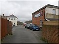
Pokesdown: footpath G03 arrives on Morley Road
This public footpath is essentially a rear access driveway for odd numbered shops 881-895 Christchurch Road (to our left) and the flats above. We are midway along it here, from Rosebery Road, behind us, to Morley Road, just ahead.
See Image for the next view on the path behind us, and Image for the view towards us from the road ahead.
Image: © Chris Downer
Taken: 25 Feb 2017
0.12 miles
8
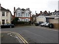
Boscombe East: footpath G07 from Colville Road
Looking across the right-angled bend along Colville Road, where a short public footpath leads to the end of Colonnade Road. It is literally just a couple of yards between the two carriageways but the public right of way measures in at 18 metres, so it must include the first stretch of Colonnade Road.
See Image for a photo looking towards us from along the path.
Image: © Chris Downer
Taken: 25 Feb 2017
0.13 miles
9
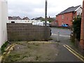
Boscombe East: footpath G07 arrives on Colville Road
Looking from the end of Colonnade Road onto Colville Road; the route between the two is a public footpath. It is literally just a couple of yards between the two carriageways but the public right of way measures in at 18 metres, so it must include the stretch of Colonnade Road on which we are standing.
See Image for a photo looking towards us from along the path, and Image for the view from farther behind us.
Image: © Chris Downer
Taken: 25 Feb 2017
0.13 miles