IMAGES TAKEN NEAR TO
Seabourne Place, BOURNEMOUTH, BH5 2JF
Introduction
This page details the photographs taken nearby to Seabourne Place, BH5 2JF by members of the Geograph project.
The Geograph project started in 2005 with the aim of publishing, organising and preserving representative images for every square kilometre of Great Britain, Ireland and the Isle of Man.

There are currently over 7.5m images from over14,400 individuals and you can help contribute to the project by visiting https://www.geograph.org.uk
Image Map
Images are licensed for reuse under creativecommons.org/licenses/by-sa/2.0
Notes
- Clicking on the map will re-center to the selected point.
- The higher the marker number, the further away the image location is from the centre of the postcode.
Image Listing (138 Images Found)
Images are licensed for reuse under creativecommons.org/licenses/by-sa/2.0
Image
Details
Distance
1
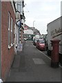
Pokesdown: postbox № BH5 60, Seabourne Road
This Victorian postbox stands outside 93 Seabourne Road, the former Pokesdown Post Office, which closed around 1998. It was replaced by the Boscombe East branch which opened in May 1997 a short distance away (which itself had closed in 1991).
On this side of the box, markings can be discerned where a stamp dispensing machine would have been affixed to the side – the word 'Office' to the right of the slot is defaced by this.
Image: © Chris Downer
Taken: 25 Oct 2008
0.03 miles
2
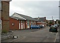
Pokesdown, citadel
In Norwood Place, off Seabourne Road. The original building to the right is dated 1907; the modern bears a sign for Pokesdown Temple Corps. http://www1.salvationarmy.org.uk/uki/www_uki.nsf/stc-vw-sublinks/ACB02E31258A516480256FC100422C37?openDocument
Image: © Mike Faherty
Taken: 14 Jul 2010
0.05 miles
4
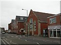
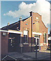
Southbourne Library
On Seabourne Road. http://www.bournemouth.gov.uk/Residents/Libraries/Info/southbourne2.asp
Image: © Mike Faherty
Taken: 14 Jul 2010
0.06 miles
5
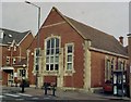
Former Pokesdown Methodist Church
Erected in 1907 as a Methodist Chapel but now used as Pokesdown Public Library.
Image: © Michael FORD
Taken: Unknown
0.06 miles
6
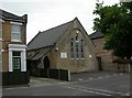
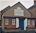
Pokesdown, meeting room
Brethren's Meeting Room, on Darracott Road.
Image: © Mike Faherty
Taken: 14 Jul 2010
0.06 miles
7
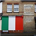
Impressive ghost sign on Harcourt Road
The business name appears to have been overwritten, but other than that in very good condition.
Image: © David Lally
Taken: 12 Mar 2017
0.07 miles
8
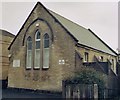
Pokesdown Brethren Chapel
Erected in 1874 for the Methodists.
Image: © Michael FORD
Taken: Unknown
0.07 miles
9
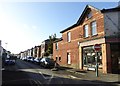
Harcourt Road, Pokesdown
A residential road of detached houses
Image: © David Smith
Taken: 25 Jan 2018
0.07 miles