
IMAGES TAKEN NEAR TO
Seabourne Road, BOURNEMOUTH, BH5 2JB
Introduction
This page details the photographs taken nearby to Seabourne Road, BH5 2JB by members of the Geograph project.
The Geograph project started in 2005 with the aim of publishing, organising and preserving representative images for every square kilometre of Great Britain, Ireland and the Isle of Man.

There are currently over 7.5m images from over14,400 individuals and you can help contribute to the project by visiting https://www.geograph.org.uk
Image Map
Images are licensed for reuse under creativecommons.org/licenses/by-sa/2.0
Notes
- Clicking on the map will re-center to the selected point.
- The higher the marker number, the further away the image location is from the centre of the postcode.
Image Listing (135 Images Found)
Images are licensed for reuse under creativecommons.org/licenses/by-sa/2.0
Image
Details
Distance
1
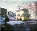
Bournemouth trolleybus in West Southbourne
A 1962 Sunbeam MF2B trolleybus on route 21 to Christchurch via Tuckton. It is pictured in Southbourne Grove having come along Seabourne Road from Pokesdown. The feeder cable supplying electricity current to the overhead wiring can be seen at the top of the photo.
Image: © David Hillas
Taken: 5 Apr 1969
0.02 miles
2
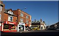
Shops in West Southbourne
The bus is emerging from Beresford Road; at this point, Seabourne Road (left) become Southbourne Grove.
Image: © Derek Harper
Taken: 10 Mar 2010
0.02 miles
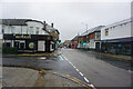
4
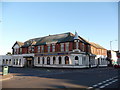
Southbourne: the Malt & Hops
A pub which, apparently, ceased trading a few days ago. Certainly, it was closed now as I walked past it.
Image: © Chris Downer
Taken: 26 Dec 2008
0.03 miles
5
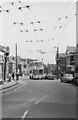
Bournemouth Corporation trolleybus 271 on Beresford Road ? 1969
On service 23 from Tuckton Bridge via Cranleigh Road, taken on the last day of normal trolleybus operation in Bournemouth.
This is one of a series of views featuring buses in the 60s, 70s, and 80s. http://www.geograph.org.uk/search.php?i=137652761
Image: © Alan Murray-Rust
Taken: 19 Apr 1969
0.03 miles
6
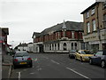
Southbourne, The Malt & Hops
On the corner of Seabourne Road and Castlemain Avenue; closed 2009.
Image: © Mike Faherty
Taken: 14 Jul 2010
0.03 miles
9

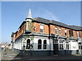
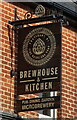
Southbourne, Brewhouse and Kitchen
Re-opened this year after several years of closure, formerly Image Internally, bar, front centre; drinking and eating areas left and right; microbrewery vessels visible back left, eating areas left and right back; terrace, background music. Decor could be described as post-industrial chic, with distressed woodwork, exposed electrical conduits and hacked-off plasterwork. Seven cask ales were on offer at my visit. http://www.brewhouseandkitchen.com/venue/southbourne/
Image: © Mike Faherty
Taken: 14 Nov 2016
0.04 miles
10
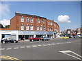
Southbourne, Portman Terrace
At the eastern end of Wentworth Avenue.
Image: © Mike Faherty
Taken: 25 Jul 2014
0.05 miles