
IMAGES TAKEN NEAR TO
Cromwell Gardens, BOURNEMOUTH, BH5 2DG
Introduction
This page details the photographs taken nearby to Cromwell Gardens, BH5 2DG by members of the Geograph project.
The Geograph project started in 2005 with the aim of publishing, organising and preserving representative images for every square kilometre of Great Britain, Ireland and the Isle of Man.

There are currently over 7.5m images from over14,400 individuals and you can help contribute to the project by visiting https://www.geograph.org.uk
Image Map
Images are licensed for reuse under creativecommons.org/licenses/by-sa/2.0
Notes
- Clicking on the map will re-center to the selected point.
- The higher the marker number, the further away the image location is from the centre of the postcode.
Image Listing (161 Images Found)
Images are licensed for reuse under creativecommons.org/licenses/by-sa/2.0
Image
Details
Distance
1
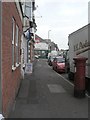
Pokesdown: postbox № BH5 60, Seabourne Road
This Victorian postbox stands outside 93 Seabourne Road, the former Pokesdown Post Office, which closed around 1998. It was replaced by the Boscombe East branch which opened in May 1997 a short distance away (which itself had closed in 1991).
On this side of the box, markings can be discerned where a stamp dispensing machine would have been affixed to the side – the word 'Office' to the right of the slot is defaced by this.
Image: © Chris Downer
Taken: 25 Oct 2008
0.04 miles
2
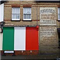
Impressive ghost sign on Harcourt Road
The business name appears to have been overwritten, but other than that in very good condition.
Image: © David Lally
Taken: 12 Mar 2017
0.05 miles
3
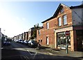
Harcourt Road, Pokesdown
A residential road of detached houses
Image: © David Smith
Taken: 25 Jan 2018
0.06 miles
4
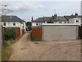
Pokesdown: double garage on Stourvale Place
Stourvale Place is a little gravel lane off Stourvale Road, which has a few houses along it. It forms public footpath number G08 and turns a corner to come out on Wyncombe Road.
We see it here having just turned the corner, and Wyncombe Road is therefore in the distance. The garage is at the rear of a Wyncombe Road property.
See Image for the view up the lane from the junction ahead, and Image for the view behind us, with links to further pictures along both routes.
Image: © Chris Downer
Taken: 21 Jul 2016
0.06 miles
5
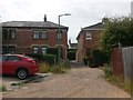
Pokesdown: approaching the bend in Stourvale Place
Stourvale Place is a little gravel lane off Stourvale Road, which has a few houses along it (seen in front of us). It forms public footpath number G08 and turns the corner to come out on Wyncombe Road. Another path, Cromwell Place, comes out on it just beyond the high hedge on the right.
We see it here from the Wyncombe Road direction - the path turns right, to run in front of the houses, to reach Stourvale Road.
See Image for the view from around the corner, and Image for the view behind us - each with links to further pictures along both routes.
Image: © Chris Downer
Taken: 21 Jul 2016
0.06 miles
6
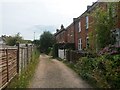
Pokesdown: the houses of Stourvale Place
Stourvale Place is a little gravel lane off Stourvale Road, which has a few houses which are seen here. It forms public footpath number G08 and turns a corner, by the lamppost ahead, to come out on Wyncombe Road. Another path, Cromwell Place, comes out on it just behind us.
See Image for the next view along the lane ahead, and Image for the next view behind us - each with links to further pictures along the mentioned routes.
Image: © Chris Downer
Taken: 21 Jul 2016
0.06 miles
7
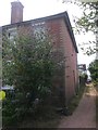
Pokesdown: the first house on Cromwell Place
Cromwell Place is a little passageway running through from the main Seabourne Road to Stourvale Place, which is itself a gravel lane. There are 5 residential properties along the lane, arranged as a little offshoot path from it.
Cromwell Place forms public footpath number G09, and we look along it here towards the Seabourne end. On the left is the first of the five houses, the other four being along the dead-end path to the left.
See Image for the view towards us from just ahead, and Image for the next view behind us - each with links to further photos along the route.
Image: © Chris Downer
Taken: 21 Jul 2016
0.06 miles
8
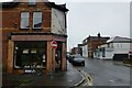
Collectors Corner
At the corner of Harcourt Road and Seabourne Road.
The painted sign is battered but can hardly be called a ghost sign as it is appropriate to the shop.
Image: © David Lally
Taken: 12 Mar 2017
0.06 miles
10
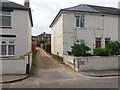
Pokesdown: Stourvale Place from Wyncombe Road
Stourvale Place is a little gravel lane off Stourvale Road, which has a few houses along it (seen in the background). It forms public footpath number G08 and turns a corner to come out on Wyncombe Road, which is where we are standing now.
The sign says "leading to Cromwell Place", but it is only as a footpath that Cromwell Place meets the lane (see Image).
See Image for the next view on the lane, with links to further pictures along both routes.
Image: © Chris Downer
Taken: 21 Jul 2016
0.06 miles