IMAGES TAKEN NEAR TO
West Road, BOURNEMOUTH, BH5 2AL
Introduction
This page details the photographs taken nearby to West Road, BH5 2AL by members of the Geograph project.
The Geograph project started in 2005 with the aim of publishing, organising and preserving representative images for every square kilometre of Great Britain, Ireland and the Isle of Man.

There are currently over 7.5m images from over14,400 individuals and you can help contribute to the project by visiting https://www.geograph.org.uk
Image Map (Loading...)


Getting Data...Please wait
Leaflet Map data © OpenStreetMap
Images are licensed for reuse under creativecommons.org/licenses/by-sa/2.0
Notes
- Clicking on the map will re-center to the selected point.
- The higher the marker number, the further away the image location is from the centre of the postcode.
Image Listing (122 Images Found)
Images are licensed for reuse under creativecommons.org/licenses/by-sa/2.0
Image
Details
Distance
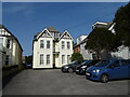
3
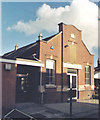
Bournemouth Deaf Centre
Opened 1995 in a converted Baptist church; at the junction of Morley & Harcourt Road, Pokesdown. For details of the centre's history & activities, see http://members.lycos.co.uk/bmthdeafclub/
Image: © Mike Faherty
Taken: 24 Feb 2009
0.09 miles
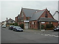
4
Former Pokesdown Baptist Church
Erected in 1891 for the Baptists but now used as Bournemouth Deaf Centre.
Image: © Michael FORD
Taken: Unknown
0.09 miles
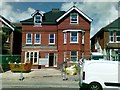
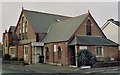
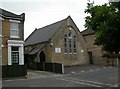
5
Pokesdown Brethren Chapel
Erected in 1874 for the Methodists.
Image: © Michael FORD
Taken: Unknown
0.10 miles
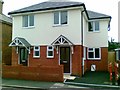
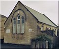
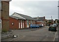
6
Pokesdown, meeting room
Brethren's Meeting Room, on Darracott Road.
Image: © Mike Faherty
Taken: 14 Jul 2010
0.11 miles
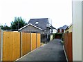
7
Pokesdown, citadel
In Norwood Place, off Seabourne Road. The original building to the right is dated 1907; the modern bears a sign for Pokesdown Temple Corps. http://www1.salvationarmy.org.uk/uki/www_uki.nsf/stc-vw-sublinks/ACB02E31258A516480256FC100422C37?openDocument
Image: © Mike Faherty
Taken: 14 Jul 2010
0.11 miles