IMAGES TAKEN NEAR TO
Beechwood Avenue, BOURNEMOUTH, BH5 1NA
Introduction
This page details the photographs taken nearby to Beechwood Avenue, BH5 1NA by members of the Geograph project.
The Geograph project started in 2005 with the aim of publishing, organising and preserving representative images for every square kilometre of Great Britain, Ireland and the Isle of Man.

There are currently over 7.5m images from over14,400 individuals and you can help contribute to the project by visiting https://www.geograph.org.uk
Image Map
Images are licensed for reuse under creativecommons.org/licenses/by-sa/2.0
Notes
- Clicking on the map will re-center to the selected point.
- The higher the marker number, the further away the image location is from the centre of the postcode.
Image Listing (46 Images Found)
Images are licensed for reuse under creativecommons.org/licenses/by-sa/2.0
Image
Details
Distance
1
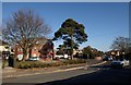
Parkwood Road, Pokesdown
A pin tree close to the junction of the B3059 with Darracott Road. To the left of the tree is Sandhills, a block of 12 flats. The car on the right has just turned out of Beechwood Avenue.
Image: © Derek Harper
Taken: 10 Mar 2010
0.05 miles
2
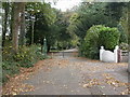
Woodland Walk, Boscombe
A pleasant tree-lined walk from Christchurch Road almost to the sea. Trees are mainly deciduous with many sweet chestnuts. This view is from where the walk crosses Beechwood Avenue; note the cast-iron pillars. The vehicles belong to tree surgeons and would not normally be there.
Image: © Mike Faherty
Taken: 23 Oct 2008
0.05 miles
3
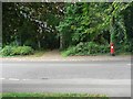
Southbourne: postbox in Beechwood Avenue before relocation
Looking across Beechwood Avenue along the path through Woodland Walk which comes out at the cliff top. In early 2010, a zebra crossing was installed at this point, and as a consequence the postbox was moved around the corner into Woodland Avenue (see Image). Presumably the crossing made it an awkward place for the postman stopping to empty the box.
Image: © Chris Downer
Taken: 19 Jul 2008
0.06 miles
4
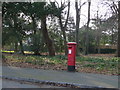
Southbourne: postbox № BH5 227, Woodland Avenue
This George V-reign postbox has its back to Woodland Walk, the linear, tree-lined park which links Boscombe centre with the cliff top. The box was moved here from around the corner (see Image) a year or two ago when a zebra crossing was installed on Beechwood Avenue.
The box is emptied finally at 5:45pm on weekdays and at 12:30pm on Saturdays.
Image: © Chris Downer
Taken: 22 Jan 2011
0.06 miles
5
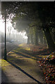
Woodlands Avenue, Woodlands Walk
Woodlands Avenue leads to Southbourne Overcliff. Woodlands Walk runs from Old Christchurch Road (Pokesdown/Boscombe) South to Southbourne Bowls Club/Southbourne Overcliff. (Listen and watch-out for Woodpeckers.)
Image: © Kim Freeman
Taken: 11 Dec 2009
0.07 miles
6
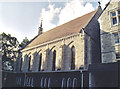
Convent of the Cross Chapel, Boscombe
Grade 2 listed building erected in 1907.
Image: © Michael FORD
Taken: Unknown
0.09 miles
7
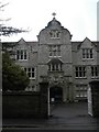
Boscombe: former Convent of the Cross
This is the central entrance of the former convent, which is now used as the Image
Image: © Chris Downer
Taken: 6 Sep 2008
0.09 miles
8
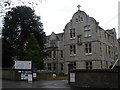
Boscombe: Anglo European College of Chiropractic
The college occupies what was once the Convent of the Cross; the building straddles the gridline and this is the northern end.
Image: © Chris Downer
Taken: 6 Sep 2008
0.12 miles
9
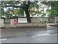
Boscombe: postbox № BH5 23, Parkwood Road
A wall-mounted George VI-reign postbox, with the Corpus Christi church hall to the right.
Image: © Chris Downer
Taken: 6 Sep 2008
0.13 miles