1
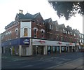
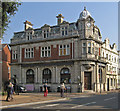
Boscombe, building site
At the corner of Adeline Road and Roumelia Lane; formerly http://www.geograph.org.uk/photo/1380005, soon to be flats, part of the portfolio of a Bournemouth property magnate.
Image: © Mike Faherty
Taken: 16 Jan 2012
0.02 miles
2
Boscombe, Adeline Road Surgery
Shortly to move to part of renovated
Image, and be known as Shelley Manor Medical Centre. http://www.adelineroadsurgery.co.uk/index.htm
Image: © Mike Faherty
Taken: 1 Jul 2009
0.02 miles
3
Boscombe, Roumelia Lane
Running parallel to Christchurch Road; recently renovated, with new road surface & lighting, and now one-way; part of Boscombe's regeneration plans http://www.bournemouth2026.org.uk/boscomberegeneration/whatwearealreadydoing/
Image: © Mike Faherty
Taken: 5 Mar 2011
0.03 miles
4
Boscombe, apartment block
At the corner of Adeline Road and Roumelia Lane, on the site of a medical surgery
Image
Image: © Mike Faherty
Taken: 25 Jun 2012
0.03 miles
5
Boscombe Underground
Brave new trading venture in the previous premises of Damart, at junction of Adeline & Christchurch Roads. Internally, stalls selling clothes, accessories & prints; has a slight alternative feel. http://bournemouth.gumtree.com/bournemouth/19/37950819.html
Image: © Mike Faherty
Taken: 1 Jul 2009
0.03 miles
6
Boscombe, road closure
Christchurch Road, closed between St. John's and Adeline Roads, unusually, not because of gas mains replacement, but because of falling masonry; brickwork from above the green-fronted tattoo parlour has collapsed, and been replaced with a plastic wedge by Dorset Fire & Rescue.
Image: © Mike Faherty
Taken: 6 Jun 2010
0.05 miles
7
Boscombe, Argos
On Christchurch Road; leaving Boscombe in the next few days, after a presence of 38 years. Robert Dyas and Peacocks have also recently left, or are about to. http://www.bournemouthecho.co.uk/news/9452335.Argos_store_in_Boscombe_closing_its_doors/
Image: © Mike Faherty
Taken: 16 Jan 2012
0.05 miles
8
Christchurch Road, Boscombe
The building on the corner of The Crescent, with its clock tower, has all the appearance of a bank, but I haven't been able to trace its origin. Next door on the right is number 506, "built as part of a row of similar buildings, the others now demolished or much altered" http://www.imagesofengland.org.uk/Details/Default.aspx?id=101934&mode=adv . The distinctive little triangular pediment is repeated several times along the street beyond.
Image: © Derek Harper
Taken: 10 Mar 2010
0.06 miles
9
Koh Thai restaurant, Boscombe
Image: © Roger Cornfoot
Taken: 10 Feb 2018
0.06 miles
10
Boscombe - former bank on The Crescent
Image: © Dave Bevis
Taken: 3 Sep 2014
0.07 miles


