
IMAGES TAKEN NEAR TO
Wharfdale Road, BOURNEMOUTH, BH4 9BU
Introduction
This page details the photographs taken nearby to Wharfdale Road, BH4 9BU by members of the Geograph project.
The Geograph project started in 2005 with the aim of publishing, organising and preserving representative images for every square kilometre of Great Britain, Ireland and the Isle of Man.

There are currently over 7.5m images from over14,400 individuals and you can help contribute to the project by visiting https://www.geograph.org.uk
Image Map
Images are licensed for reuse under creativecommons.org/licenses/by-sa/2.0
Notes
- Clicking on the map will re-center to the selected point.
- The higher the marker number, the further away the image location is from the centre of the postcode.
Image Listing (198 Images Found)
Images are licensed for reuse under creativecommons.org/licenses/by-sa/2.0
Image
Details
Distance
1
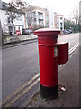
Westbourne: postbox № BH4 24, Surrey Road
This Victorian postbox was made during the period 1879-87, when the royal cipher was accidentally omitted from the front of the box. It has an unusually high slot, and it is emptied finally at 5:30pm on weekdays and at noon on Saturdays.
Image: © Chris Downer
Taken: 10 Jan 2009
0.04 miles
2
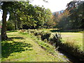
Path by Bourne Stream
In the Upper Gardens at Bournemouth
Image: © Paul Gillett
Taken: 5 Sep 2013
0.06 miles
3
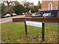
Bournemouth: Suffolk Road South
Before the by-pass dual carriageways were constructed in the early 1970s, Suffolk Road was a through route which can be visualised from the current map. It ran from The Triangle, roughly northwest, and then split into two arms, this being the more northern one.
It is thus rather odd that the other two arms should retain the name of plain Suffolk Road, while ‘South’ rather than ‘North’ was suffixed to this segment.
Image: © Chris Downer
Taken: 11 Feb 2010
0.06 miles
5
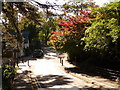
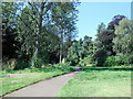
Bournemouth: Queen?s Road heads uphill from the Gardens
Having crossed the Upper Gardens, Queen's Road makes its way up towards the western side of Bournemouth town centre. Prince of Wales Road, the next road crossing point of the Gardens, is one-way in the opposite direction.
Image: © Chris Downer
Taken: 20 Oct 2010
0.07 miles
6
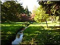
Bournemouth: upstream along the Gardens from Queen?s Road
Looking up the Bourne Stream in autumn sunshine.
Image: © Chris Downer
Taken: 20 Oct 2010
0.07 miles
7

Bournemouth Gardens: upstream from Queen?s Road
Looking up the Gardens from Queen’s Road, which crosses the Gardens here.
Image: © Chris Downer
Taken: 27 Jan 2008
0.07 miles
8
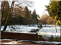
Bournemouth Gardens: upstream from Queen?s Road in snow
Looking northwest along the Upper Gardens from Queen's Road, with very little of yesterday's snow having thawed.
Image: © Chris Downer
Taken: 7 Jan 2010
0.07 miles
9
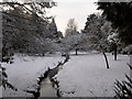
Bournemouth: snowy Gardens view from Queens Road
Looking upstream along the Gardens after Bournemouth's heaviest snow for 17 years fell overnight.
Image: © Chris Downer
Taken: 2 Dec 2010
0.08 miles
10
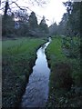
The Bourne in Upper Gardens, with a path on the right
Part of "one of the loveliest urban walks in the land" http://www.geograph.org.uk/article/A-walk-through-Bournemouth-Gardens
Image: © David Smith
Taken: 25 Jan 2018
0.08 miles