IMAGES TAKEN NEAR TO
Clarendon Road, BOURNEMOUTH, BH4 8AH
Introduction
This page details the photographs taken nearby to Clarendon Road, BH4 8AH by members of the Geograph project.
The Geograph project started in 2005 with the aim of publishing, organising and preserving representative images for every square kilometre of Great Britain, Ireland and the Isle of Man.

There are currently over 7.5m images from over14,400 individuals and you can help contribute to the project by visiting https://www.geograph.org.uk
Image Map
Images are licensed for reuse under creativecommons.org/licenses/by-sa/2.0
Notes
- Clicking on the map will re-center to the selected point.
- The higher the marker number, the further away the image location is from the centre of the postcode.
Image Listing (104 Images Found)
Images are licensed for reuse under creativecommons.org/licenses/by-sa/2.0
Image
Details
Distance
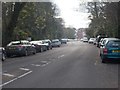
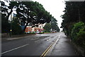
5
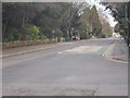
Clarendon Road
View on Clarendon Road looking north.
Image: © Mat Tuck
Taken: 22 May 2016
0.04 miles
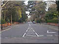
6
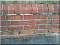
Clarendon Road cut benchmark
Ordnance Survey cut bench mark on a roadside wall in Clarendon Road, Bournemouth.
Image: © Mat Tuck
Taken: 22 May 2016
0.04 miles
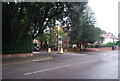
7
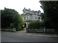
Bournemouth, Royal Victoria Hospital
Former hospital on Poole Road, with an 1887 datestone; now converted into apartments.
Image: © Mike Faherty
Taken: 8 Sep 2010
0.05 miles
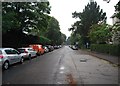
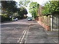
9
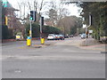
Poole Road - viewed from Clarendon Road
Image: © Betty Longbottom
Taken: 19 Apr 2016
0.07 miles